


Madrean Rugged Ramble
Distance
259 Mi.
(417 KM)Days
5-7
% Unpaved
74%
% Singletrack
40%
% Rideable (time)
95%
Total Ascent
21,000'
(6,401 M)High Point
6,063'
(1,848 M)Difficulty (1-10)
7?
- 5Climbing Scale Moderate81 FT/MI (15 M/KM)
- 7Technical Difficulty Difficult
- 7Physical Demand Difficult
- 7Resupply & Logistics Strenuous
Contributed By
Joe Cruz
Pedaling in Place
Additional photos by Neil Beltchenko and Miles Arbour
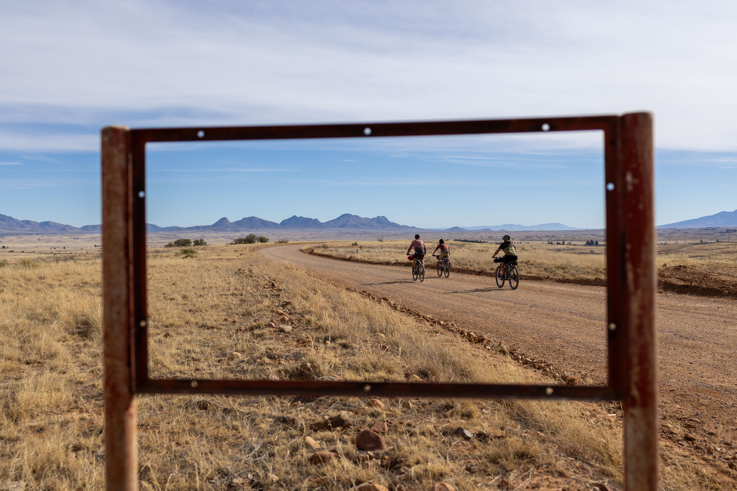
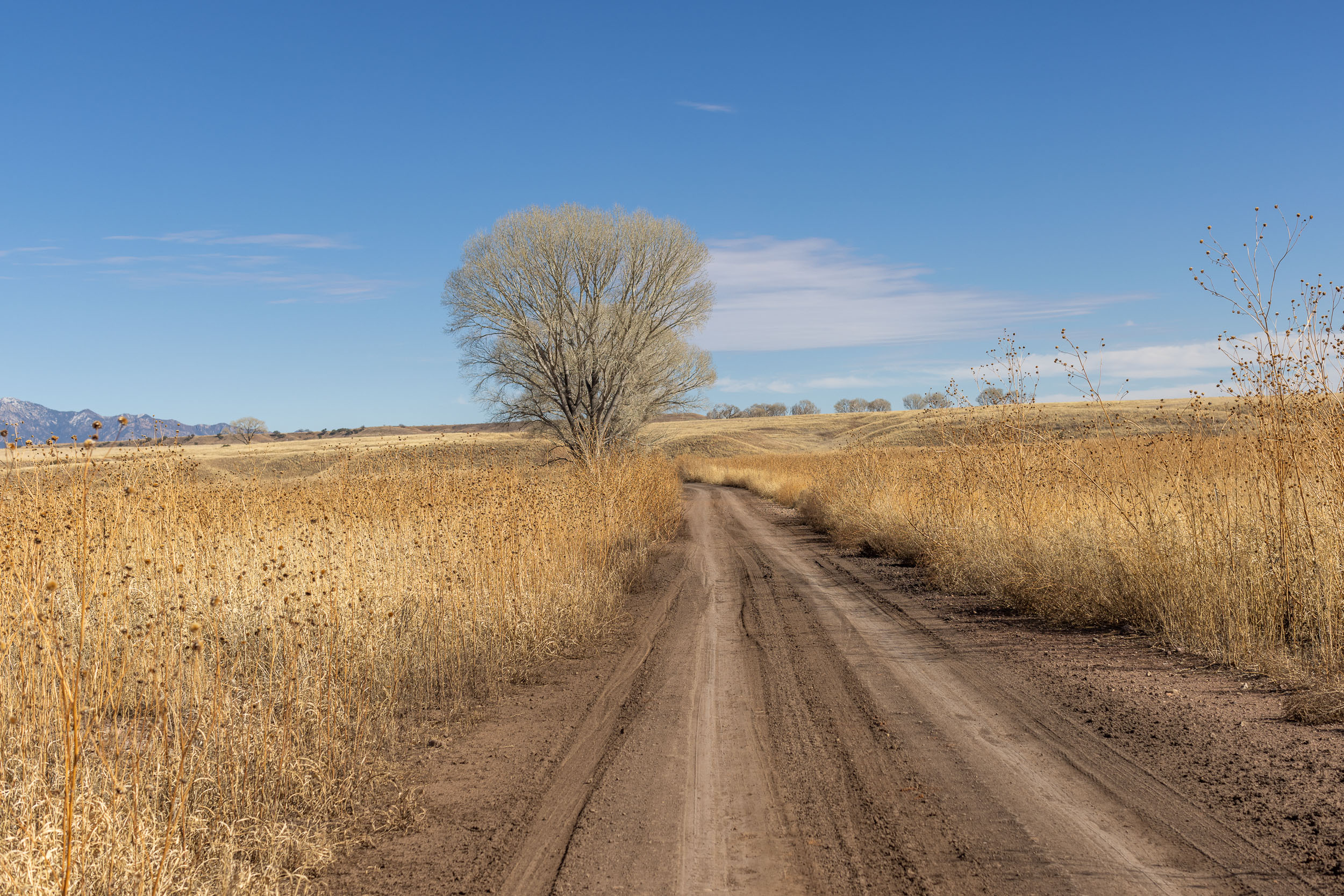
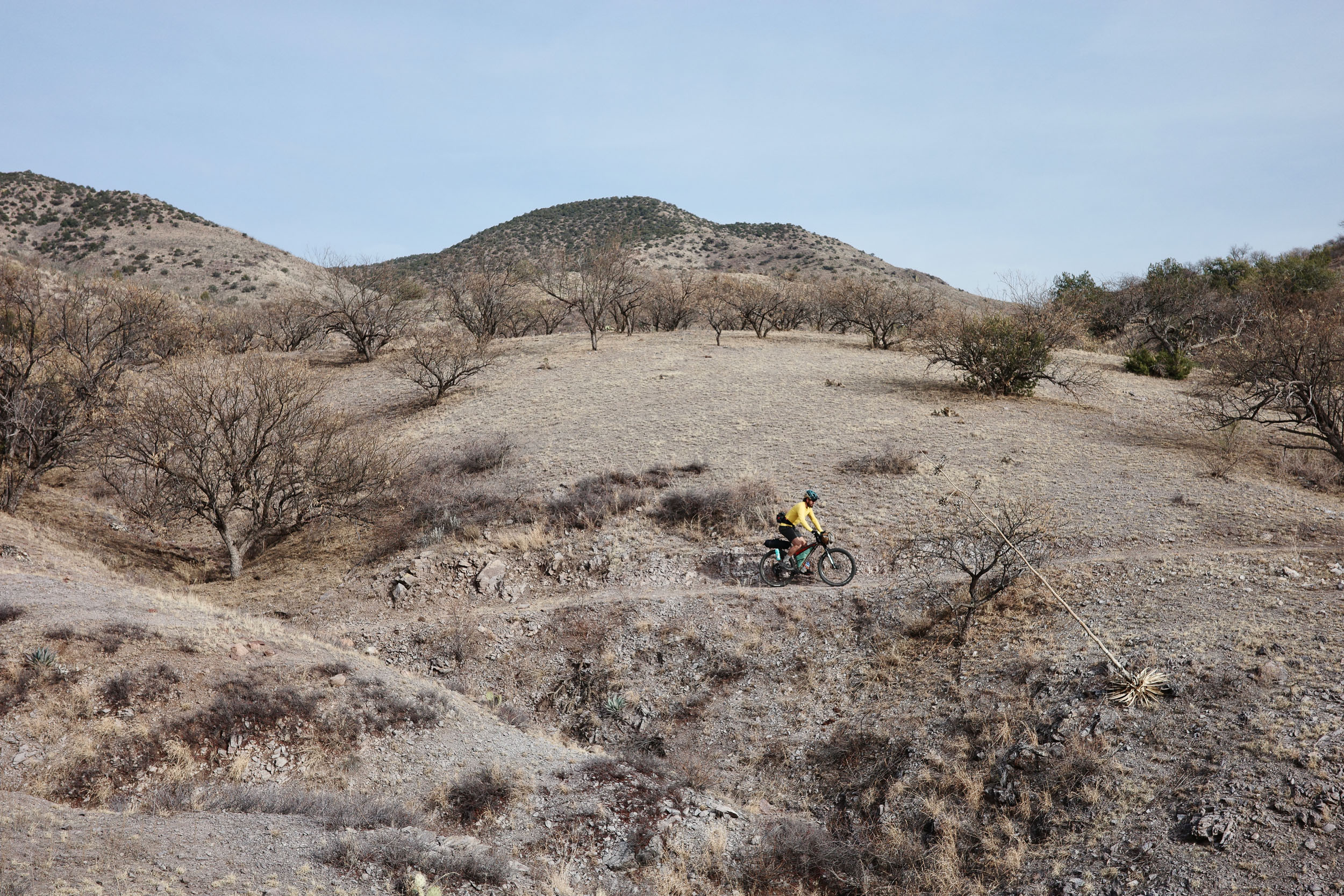
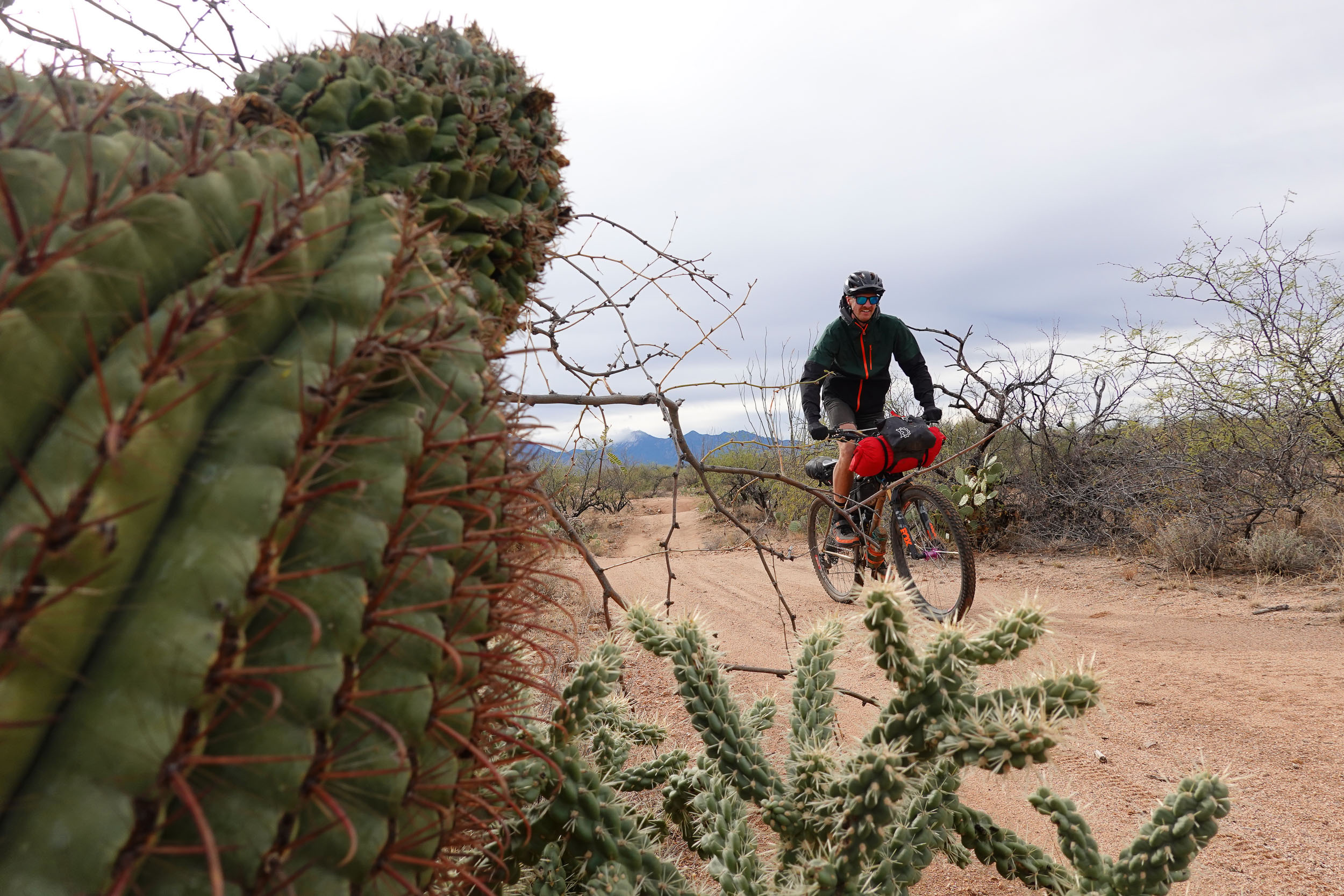
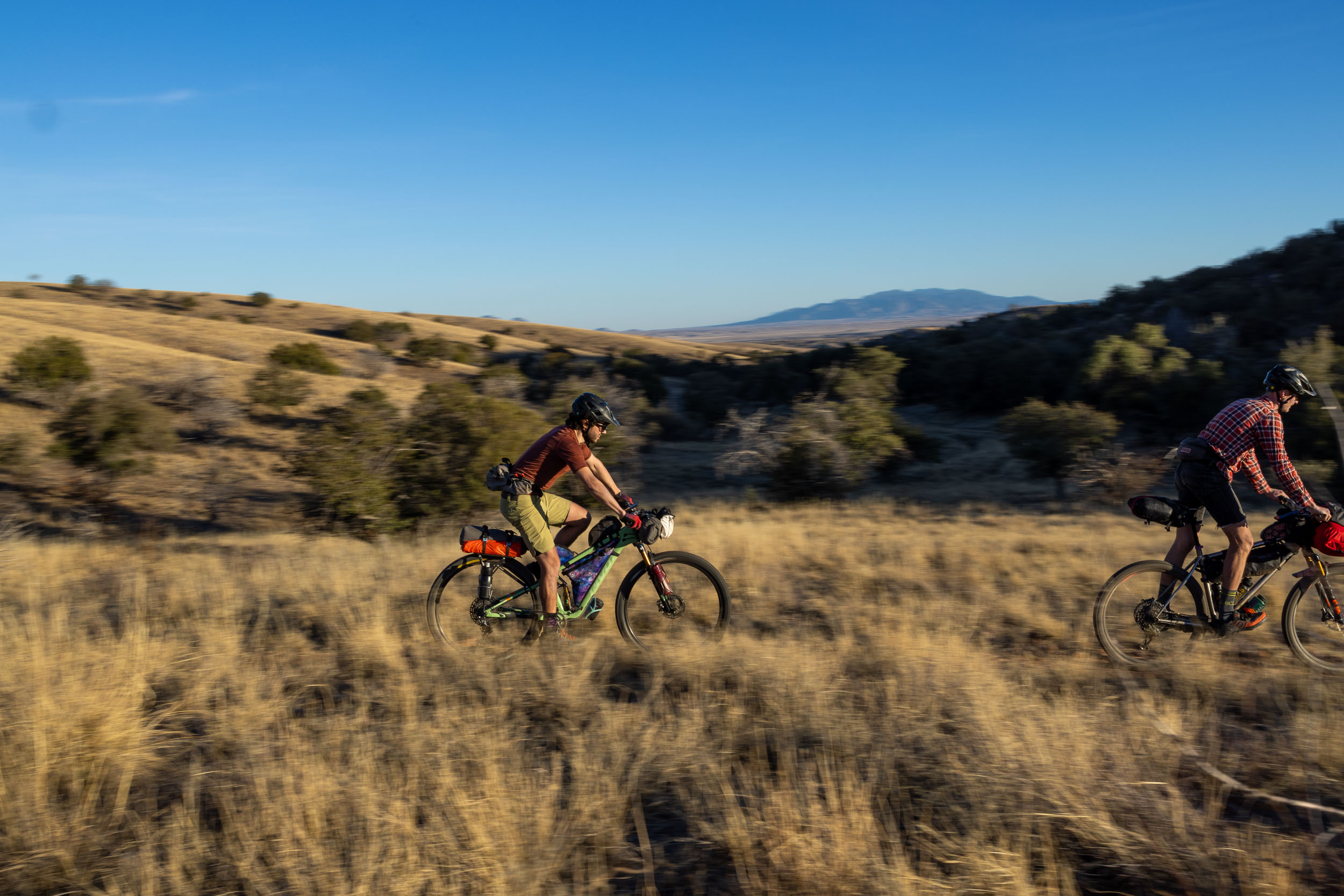
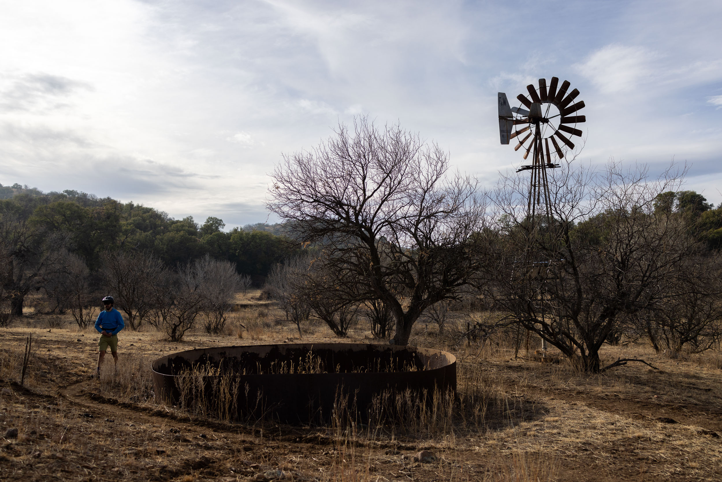
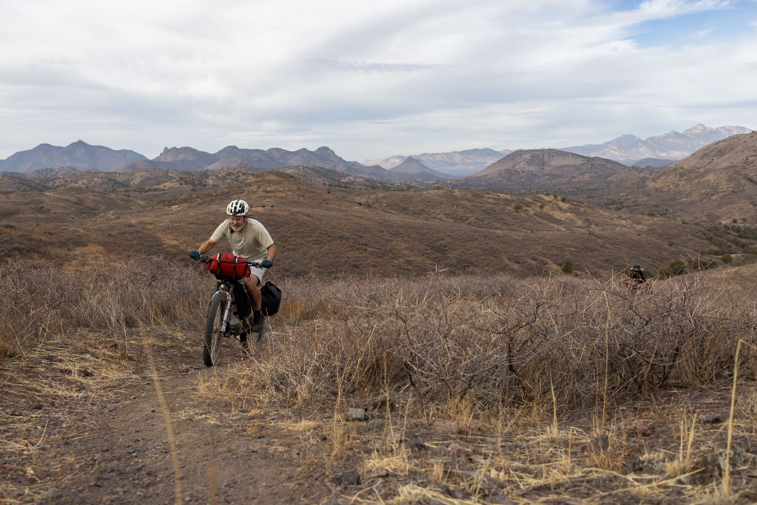
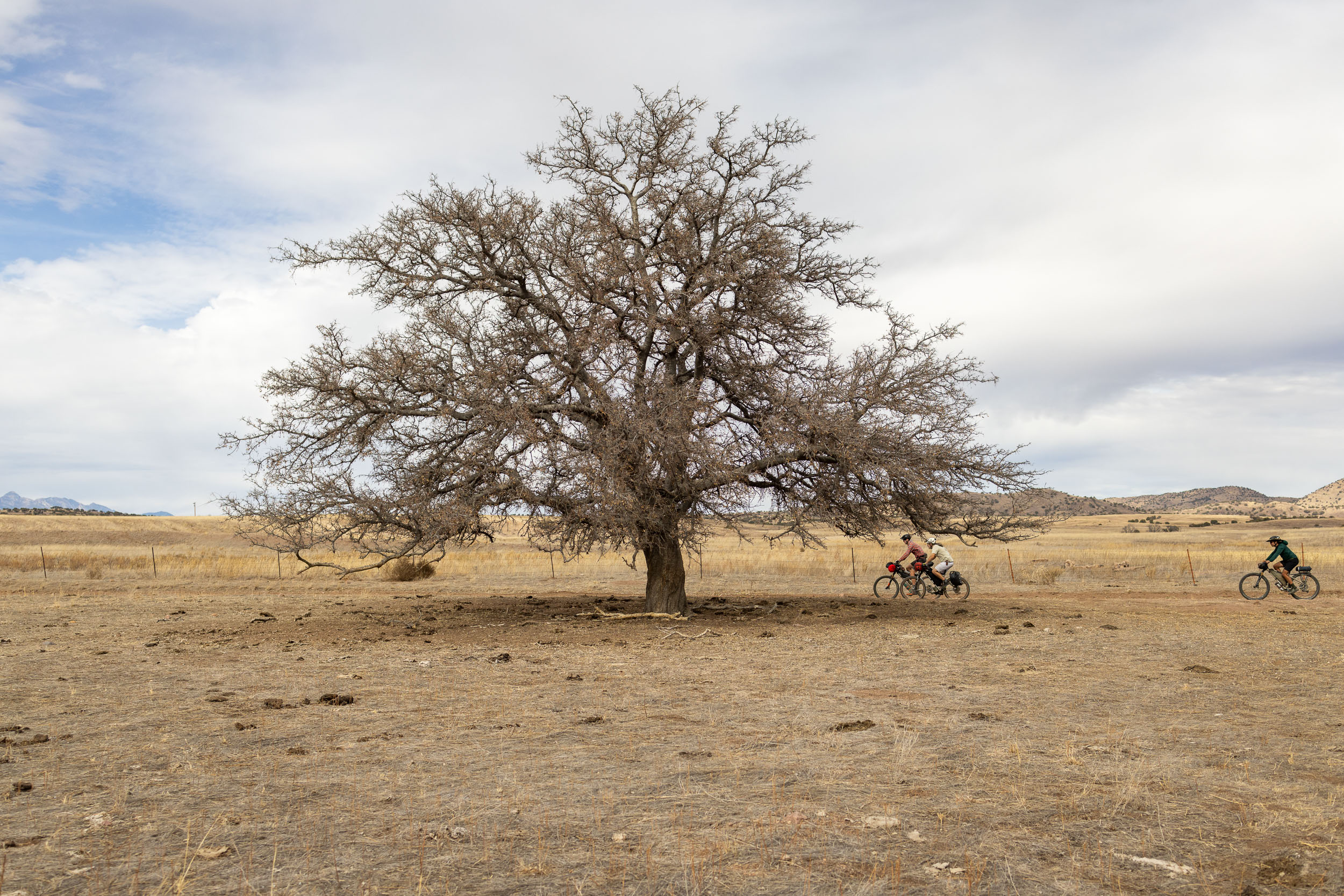
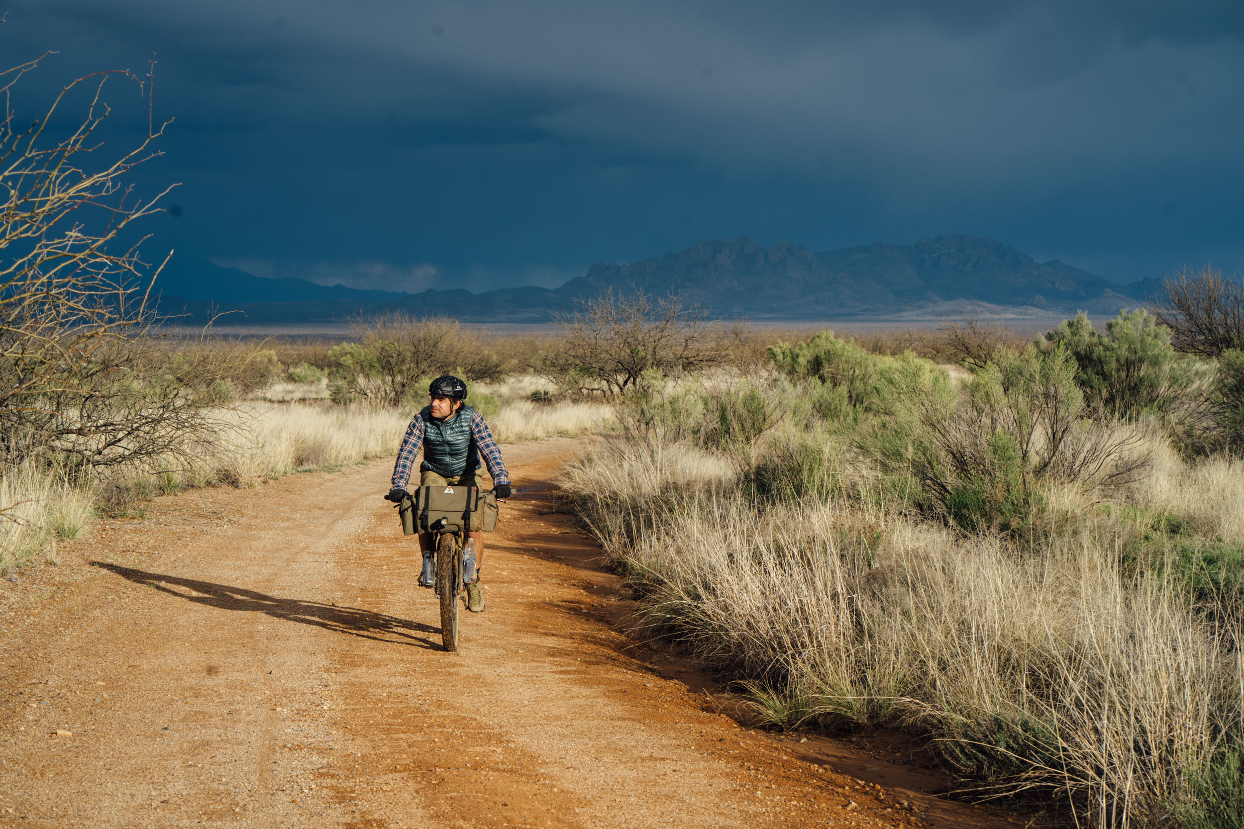
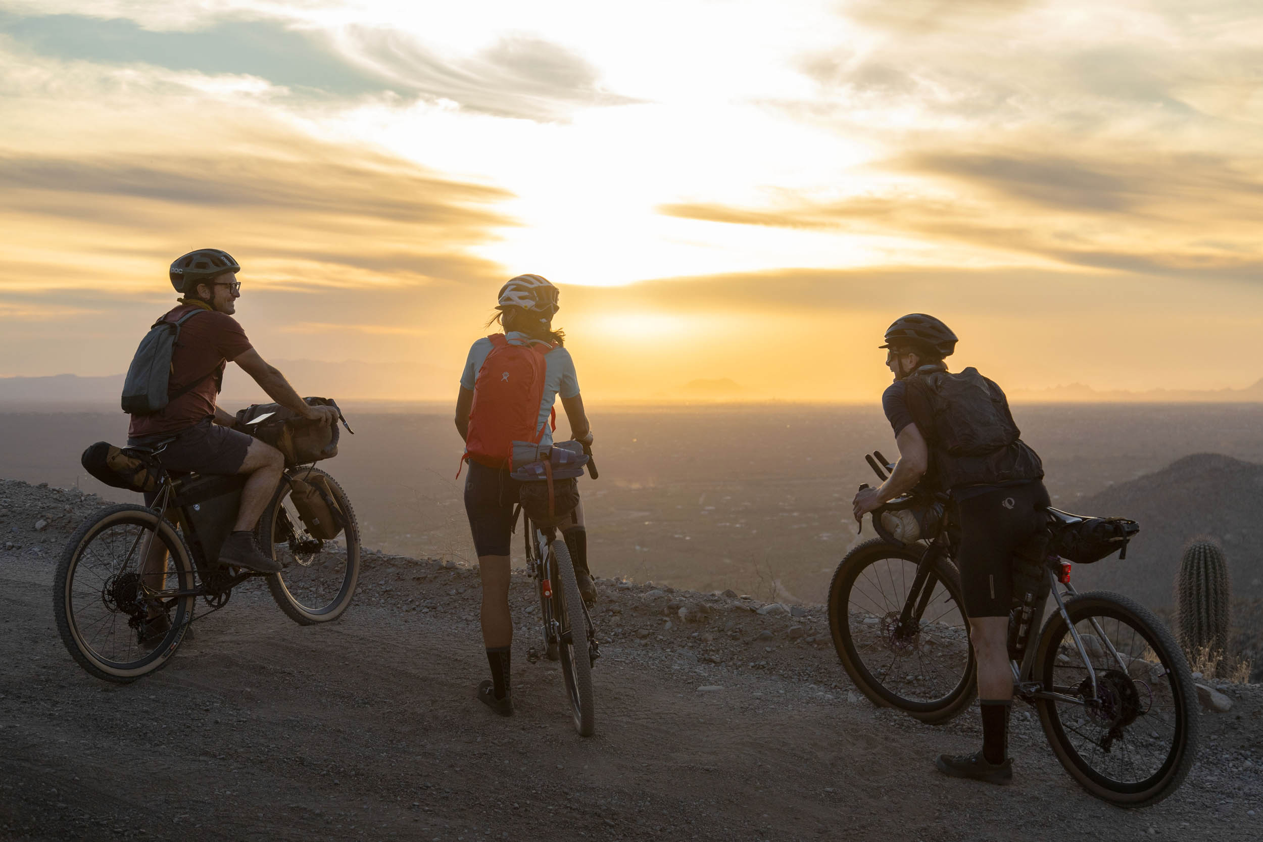
The terrain of far southeastern Arizona—an ecoregion known as the Madrean Archipelago—is a rough and rugged sort of poetry. Its crumbled peaks, defiant cactuses, and dirt tracks beaten dry by a fierce sky. In places, chaparral gives way to grasslands. The sunshine hardly lets up for 300 plus days per year. You’ll find cattle and barbed wire fences and steel windmills, though mostly there’s a feeling of open remoteness. It’s a borderland with the attendant moral complexity, yet there is also a persistent insistent serenity.
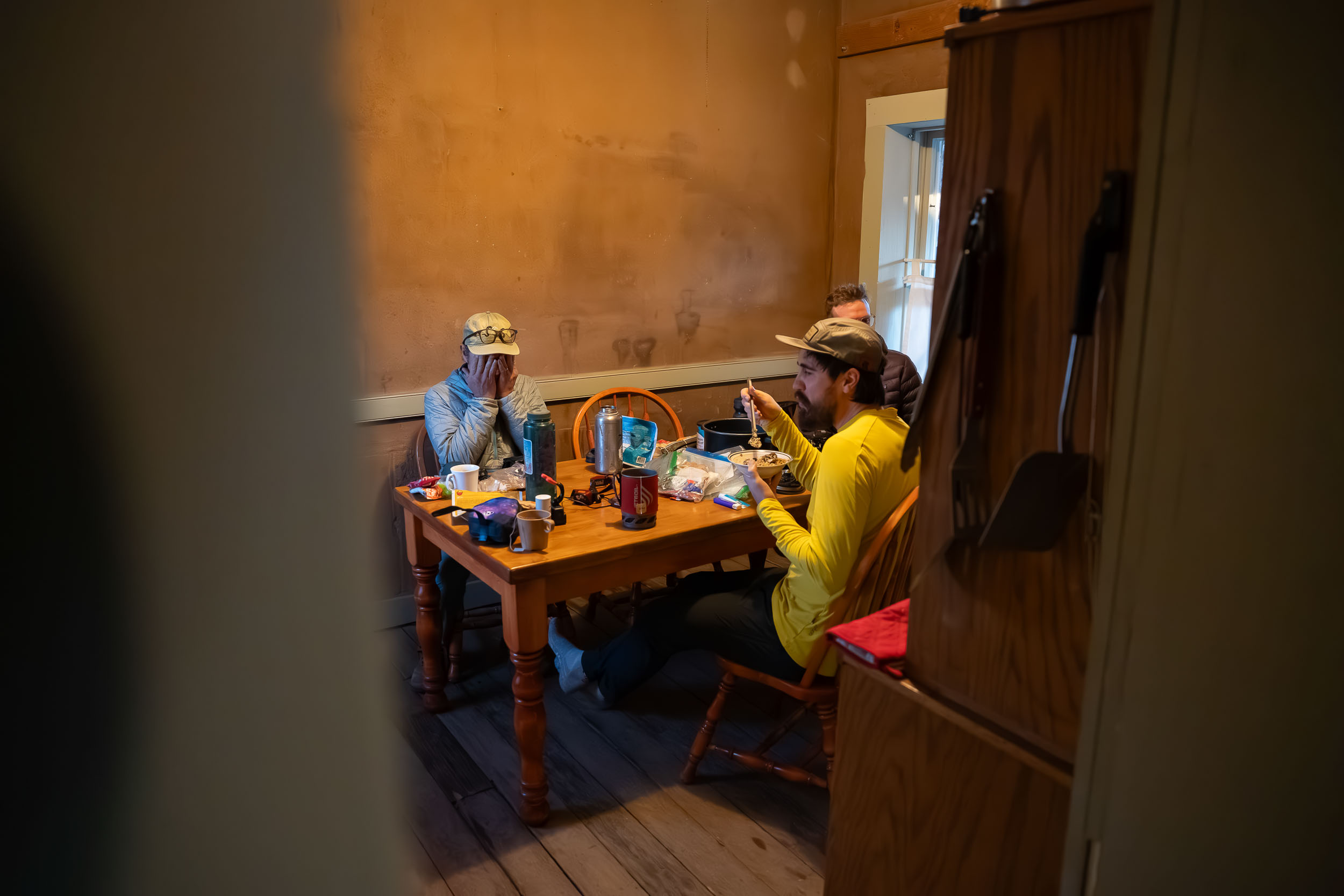
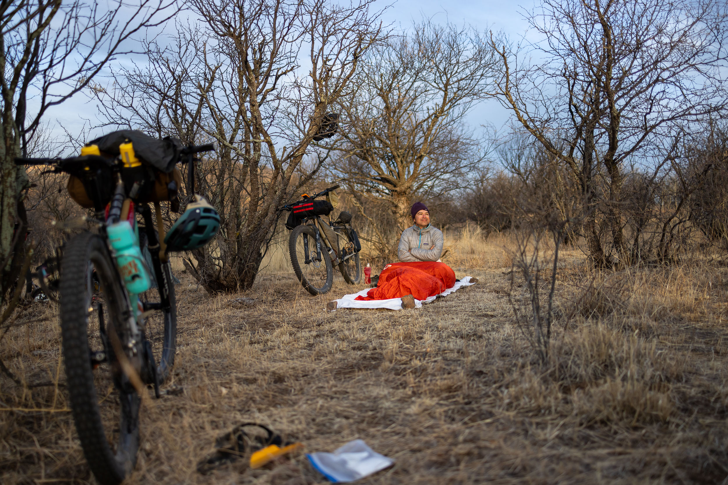
This ramble tries to take it all in in a big, committed loop. It’s conceived with resupply approximately every two days or thereabouts, so there is no need for lengthy carries of provisions. The sleeping possibilities are a good mix of wild-camp opportunities, established campgrounds, and even indoor lodging in a few spots. Overall, the logistics are straightforward. Still, it’s satisfyingly challenging due to the terrain and the otherworldly dryness of the desert.

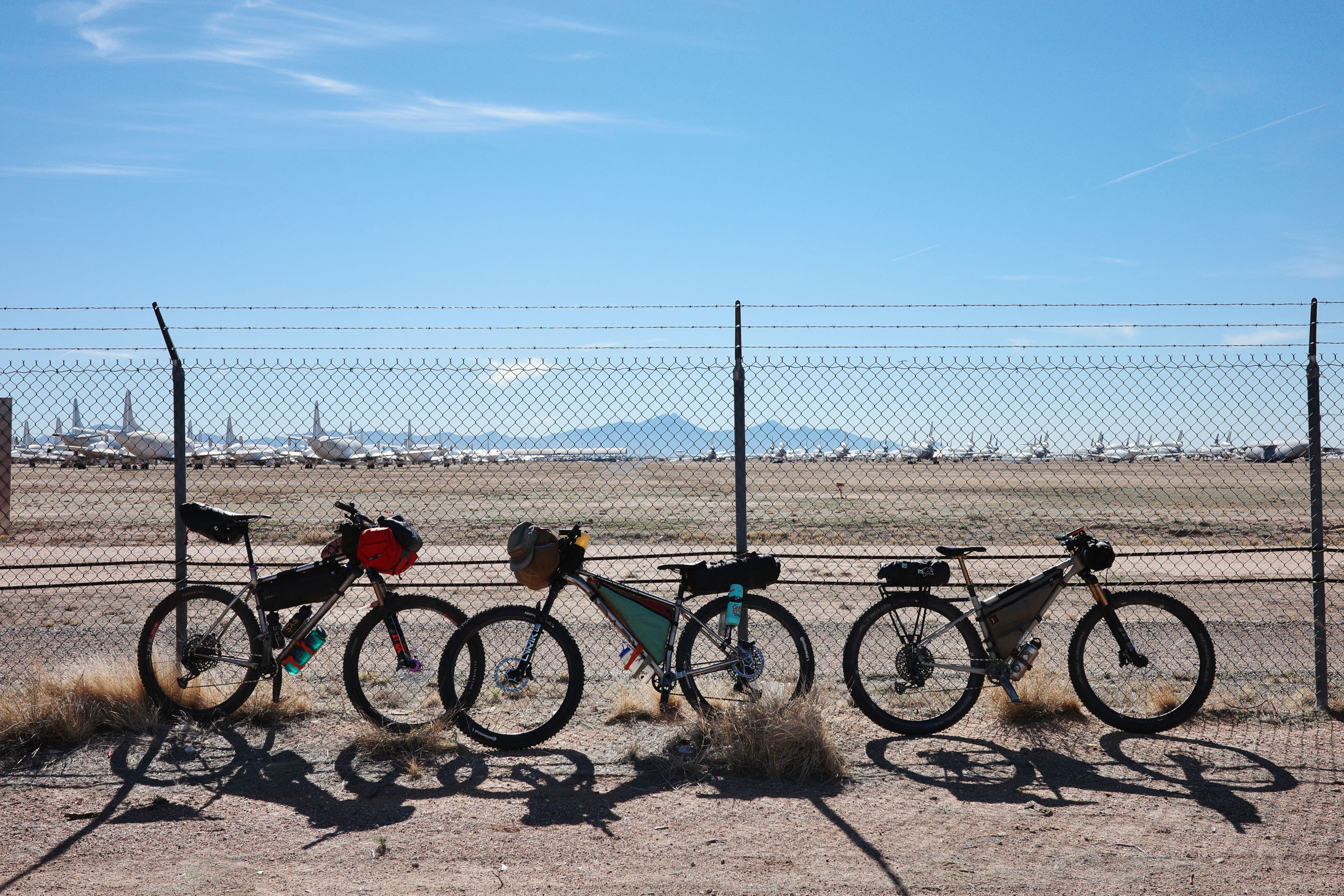
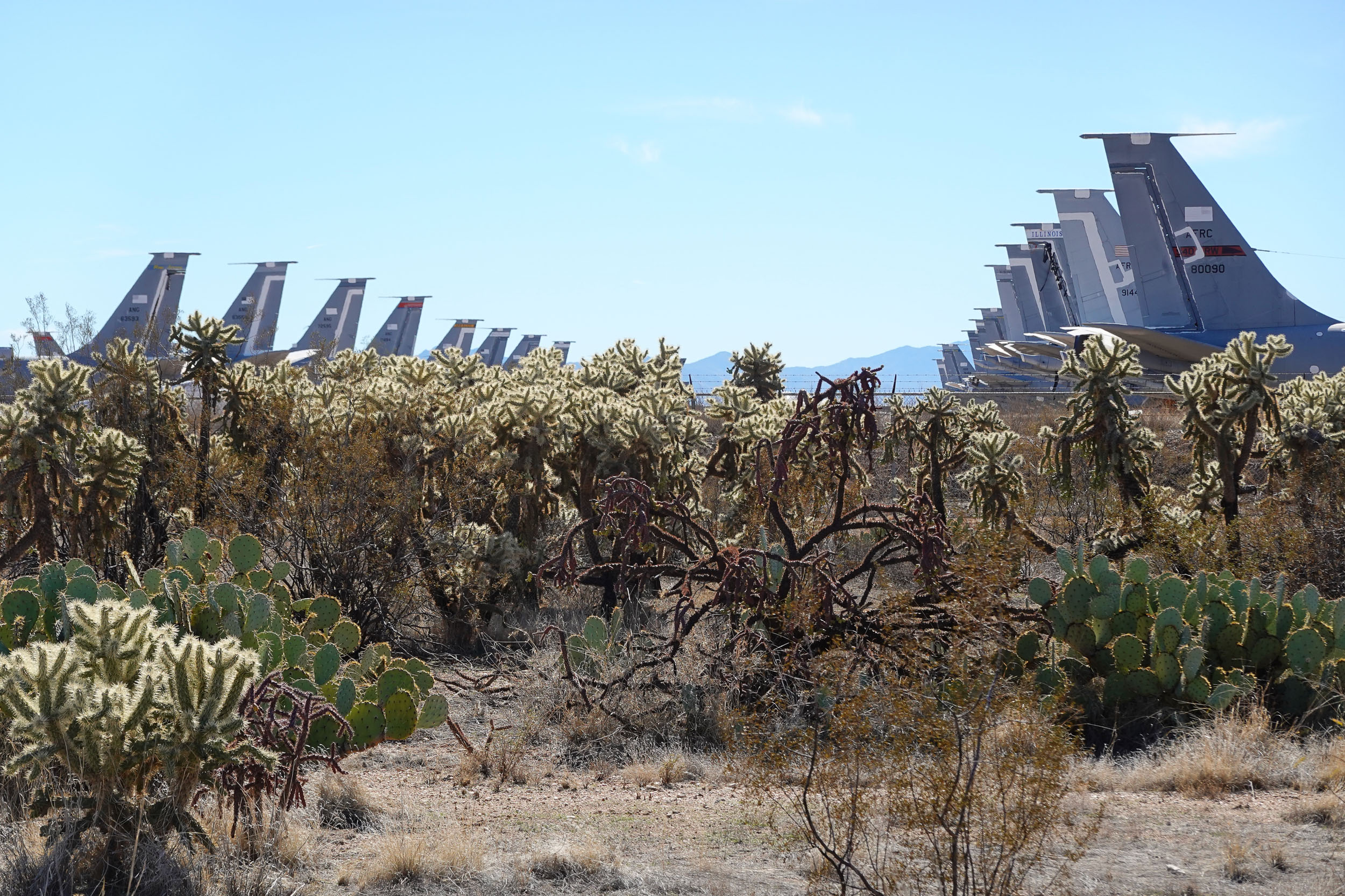
The jumping-off point of the route is Tucson, a city made of collisions of history, quirky out-westernism, the palpable wonderful culture of Mexico and Indigenous people, the flagship state university, Davis-Monthan Air Force Base, and so much more. There is sprawl and traffic and water-use challenges, but there are also fingertip-close spectacular mountains and the music of the desert. Neither cowboy boots nor Birkenstocks are out of place in Tucson, and likewise it draws professional road racers for winter training as well as gravel and mountain bikers from around the USA and abroad. As a staging area and launching point for a bikepacking trip, Tucson is enviably perfect with straightforward transportation access, every conceivable resource for preparing outdoor adventures, and many things to do and see before and after the ride.
I got to Tucson in the summer of 1991 in my Chevrolet LUV pickup truck that had somehow survived the drive from New England. On the afternoon I arrived, the thermometer at the bank near the apartment I was renting read 117°F (47°C). I was sure that I had made a catastrophic life mistake. Quite the contrary, I quickly came to love the place in every way. Most of all for me was the static pressureful heat of the desert casting into relief life and joy itself. Though I do not live there anymore, the landscape has a quiet, a precision, and a clarity that calls me back to this day. Make no mistake, the desert does not forgive foolishness. The sunlight is a hammer that will drive you into the ground if you don’t have a plan to cope. The cactuses and thorn bushes are not bluffing. The rewards of being outside there, though, are as immense as the firmament itself.
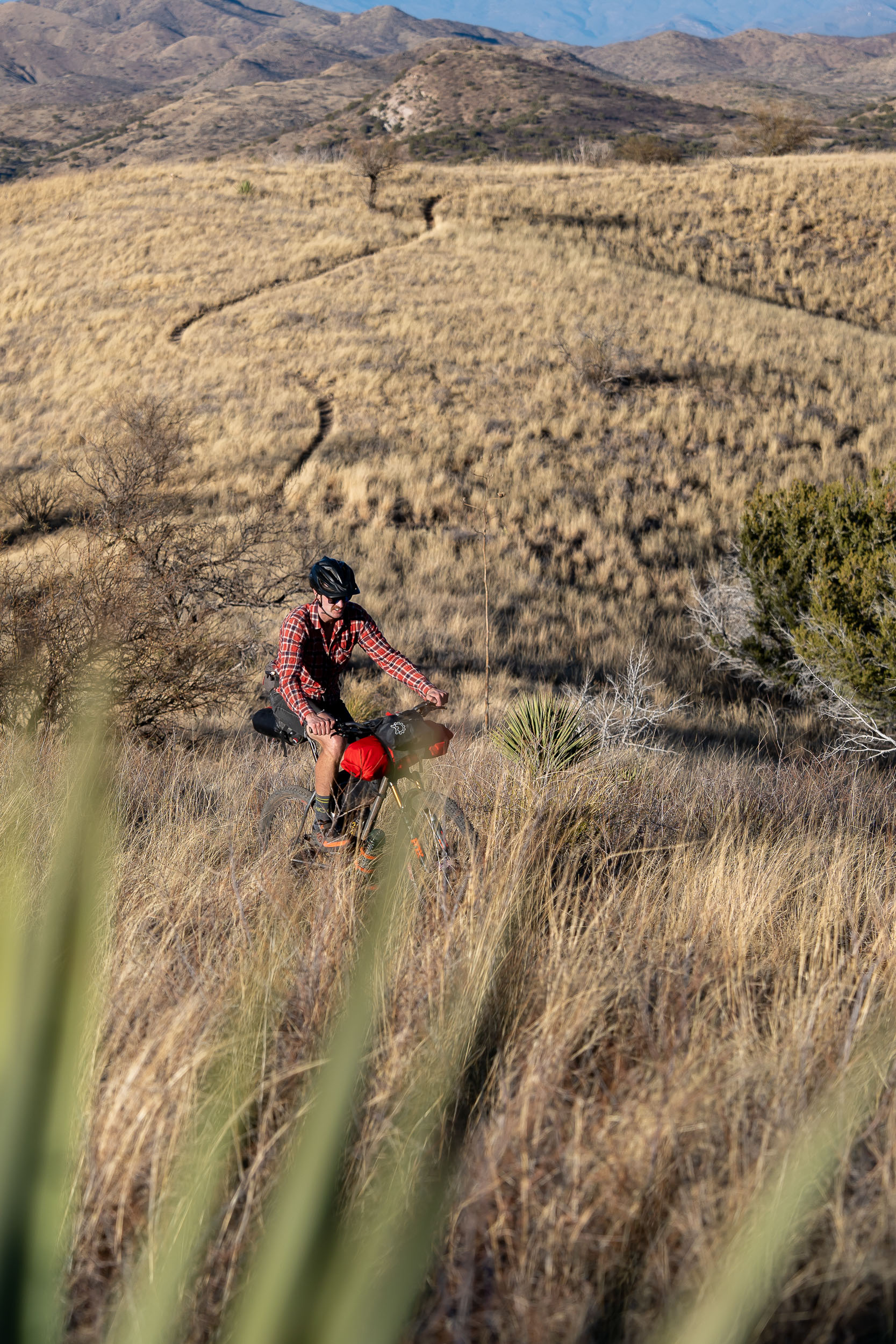
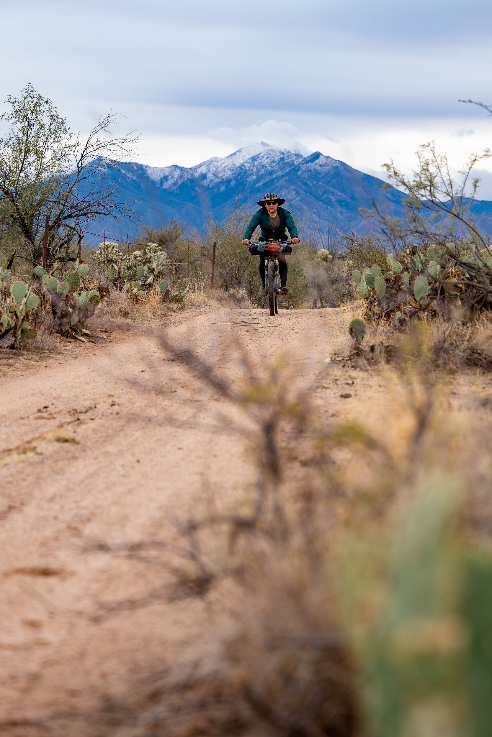
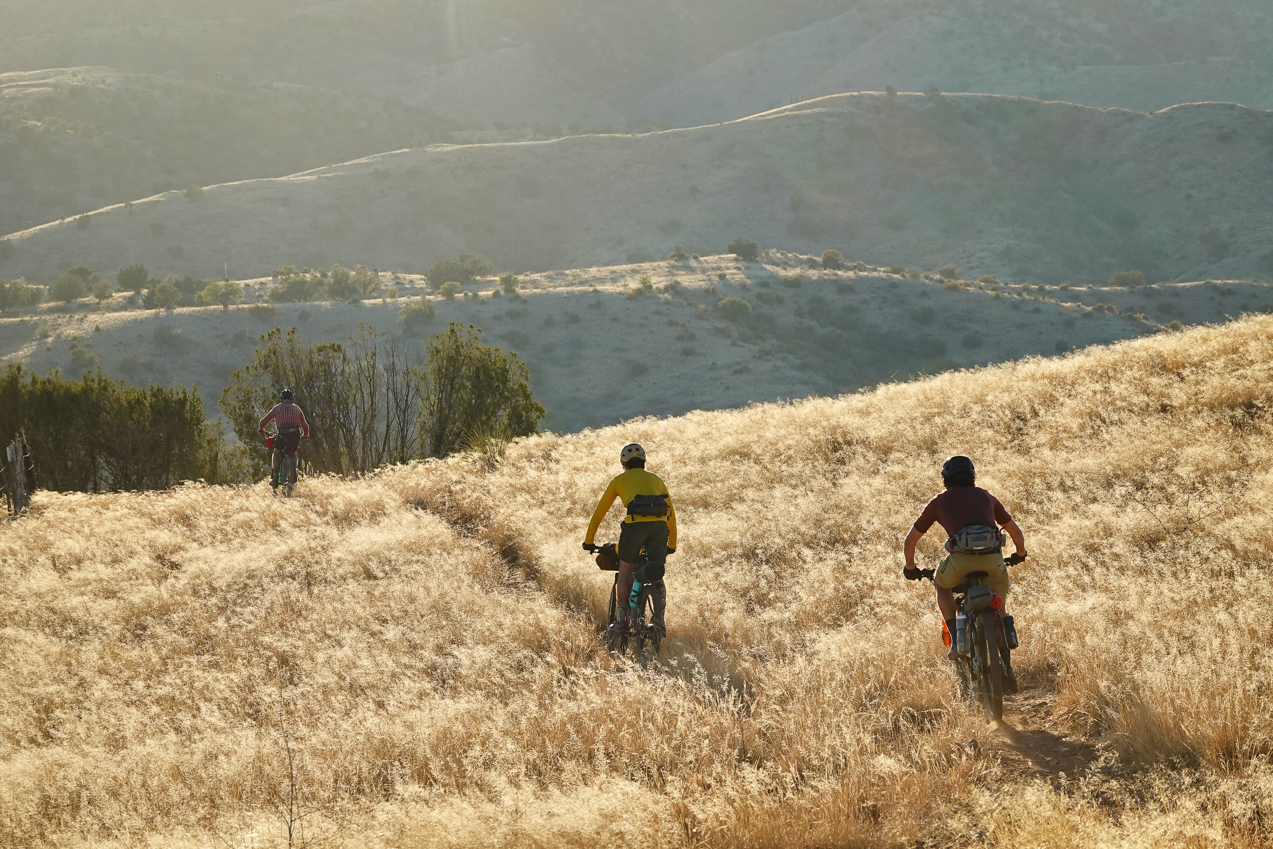
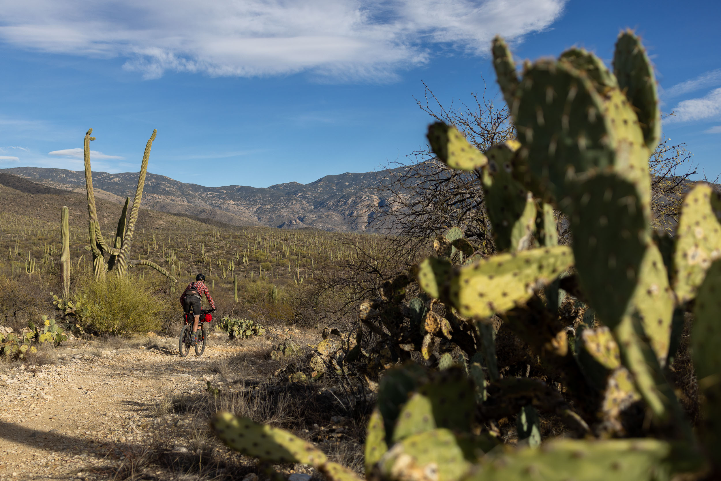
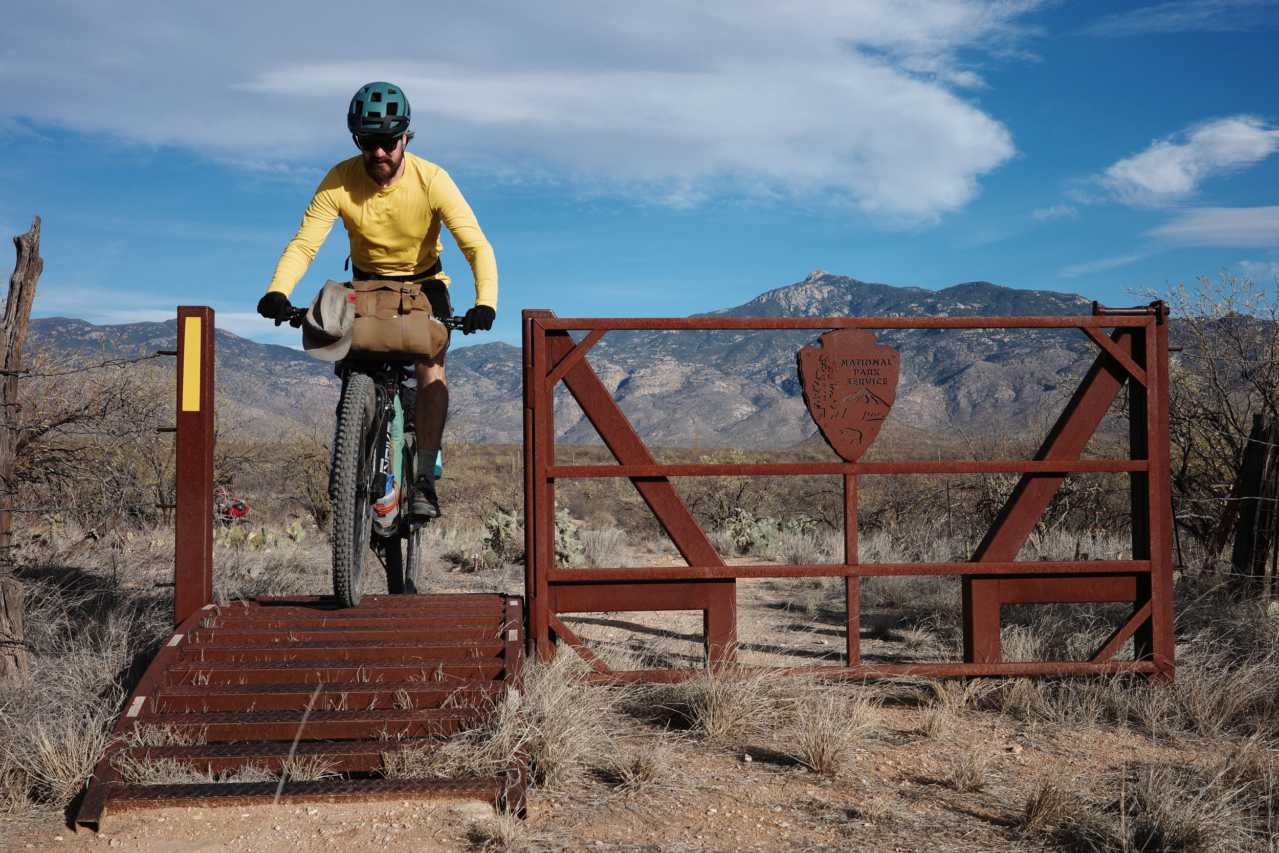
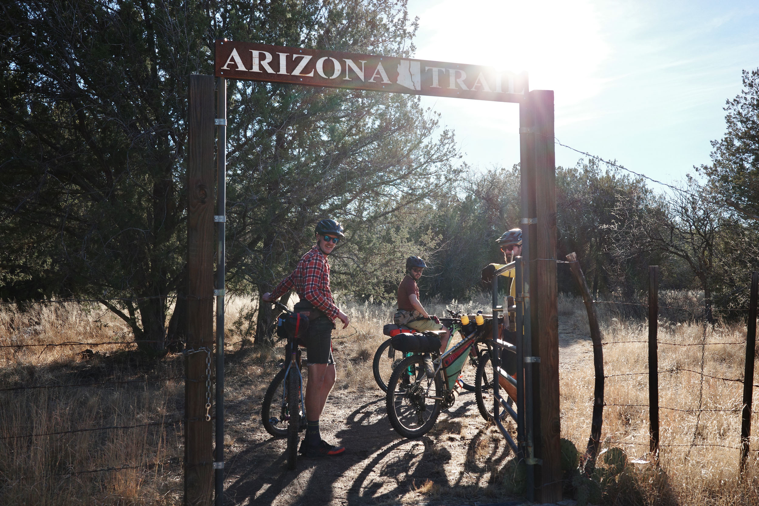
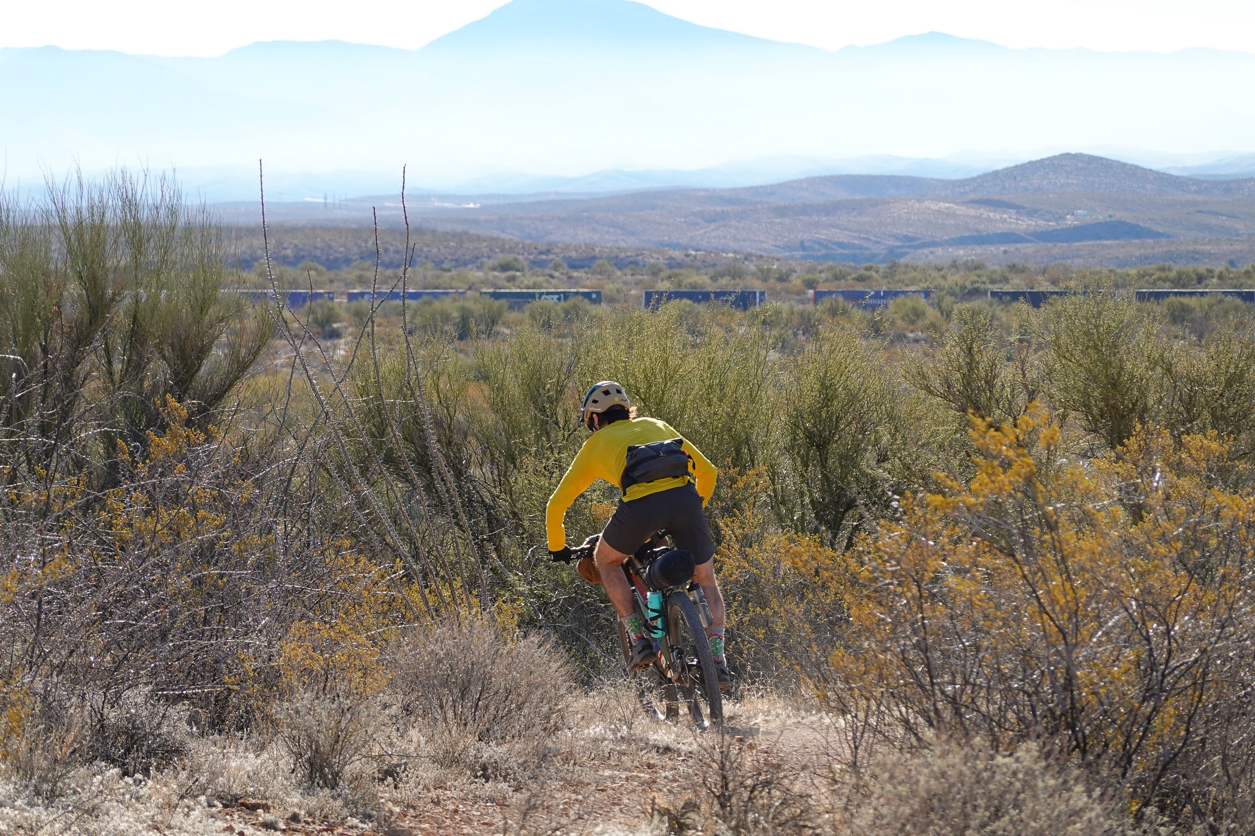
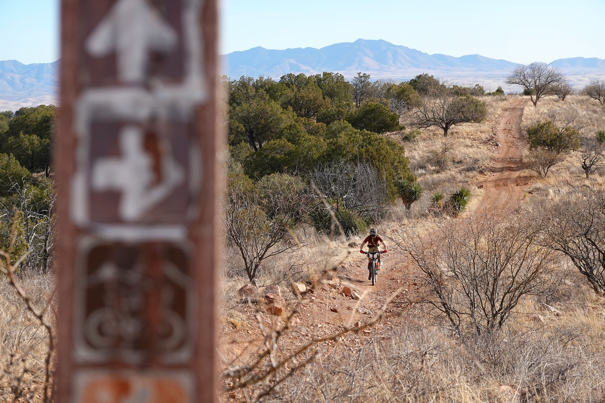
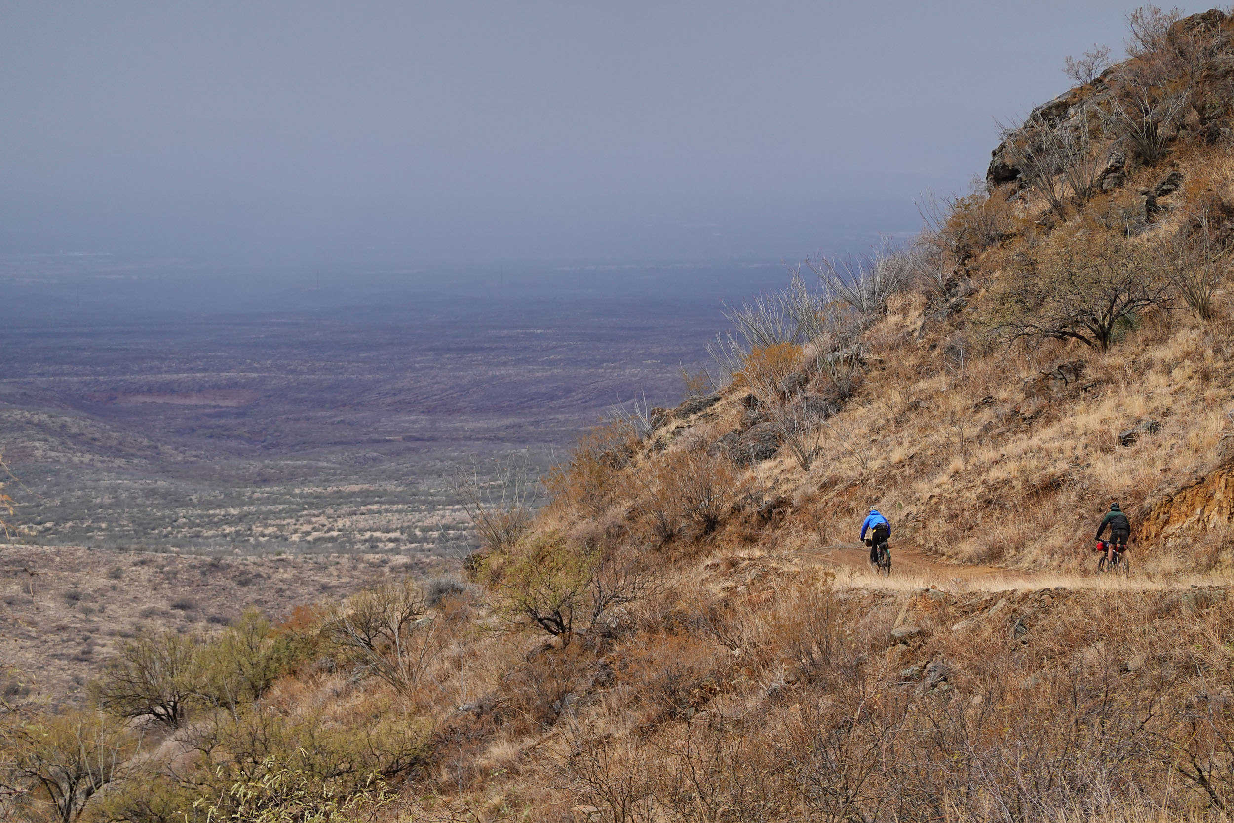
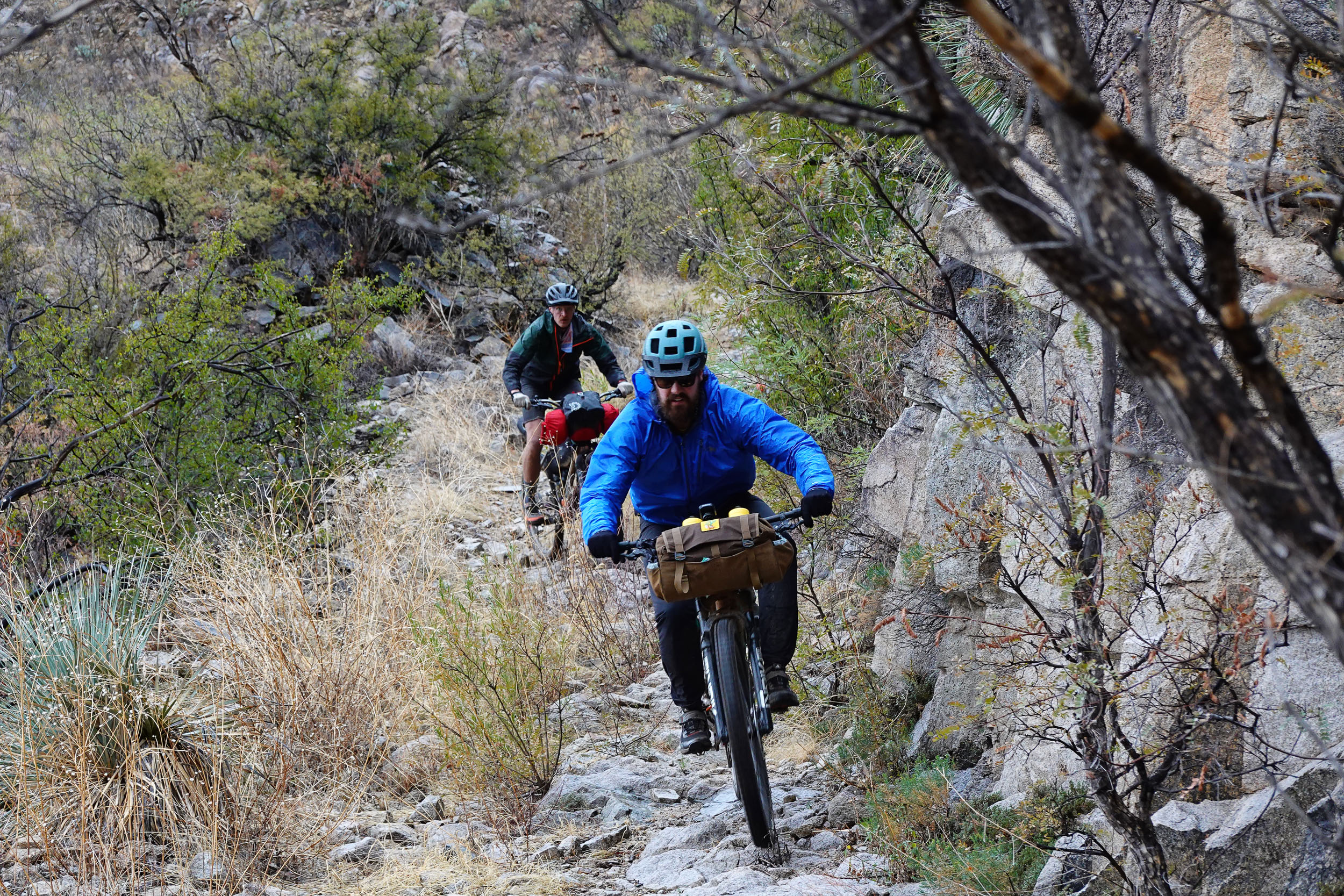
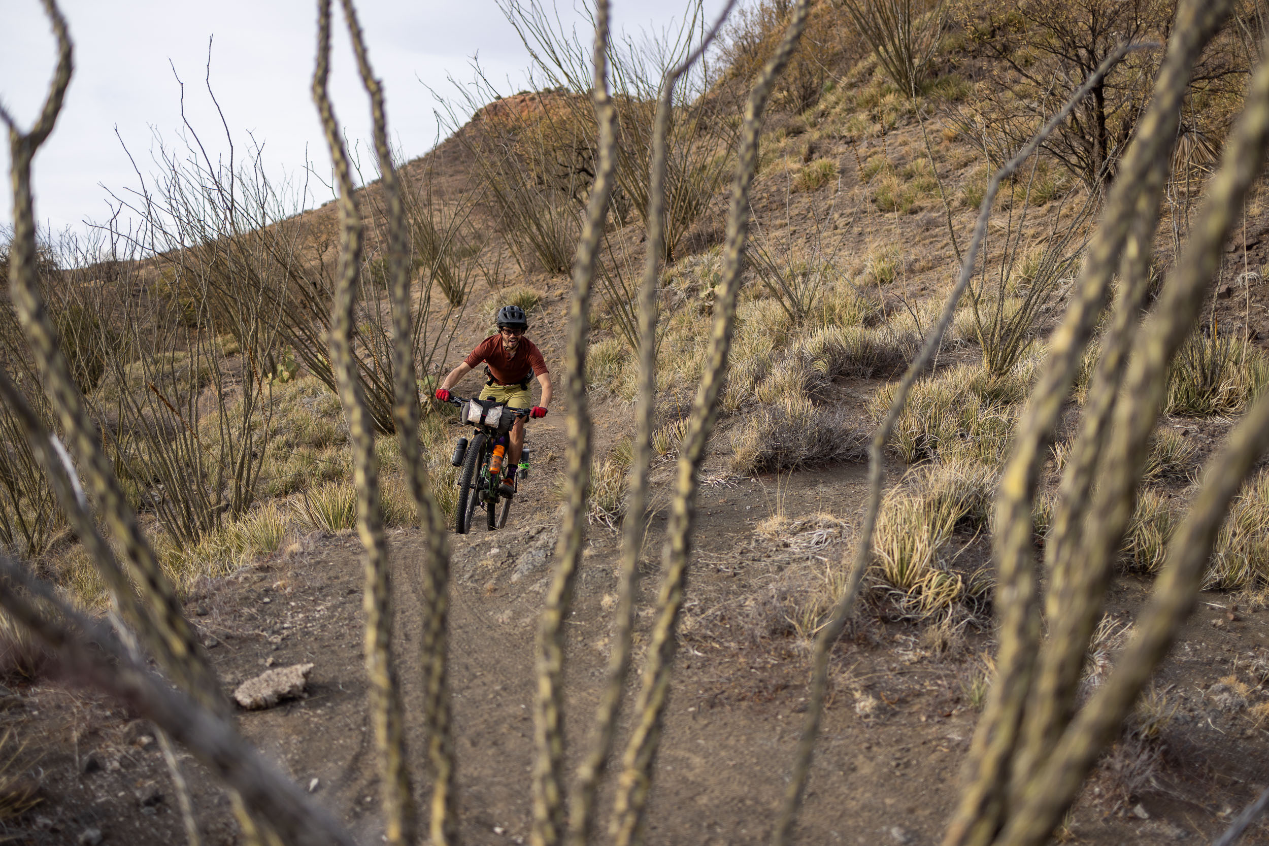
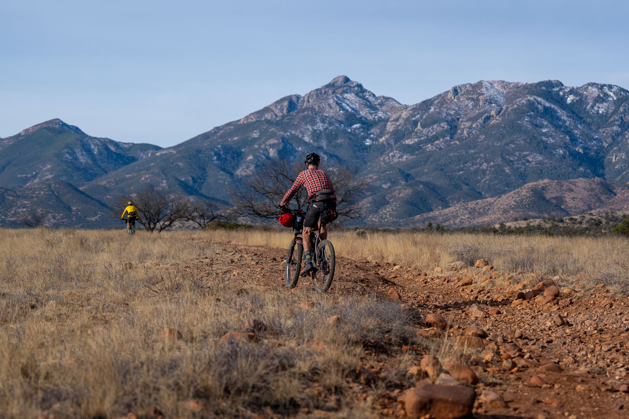
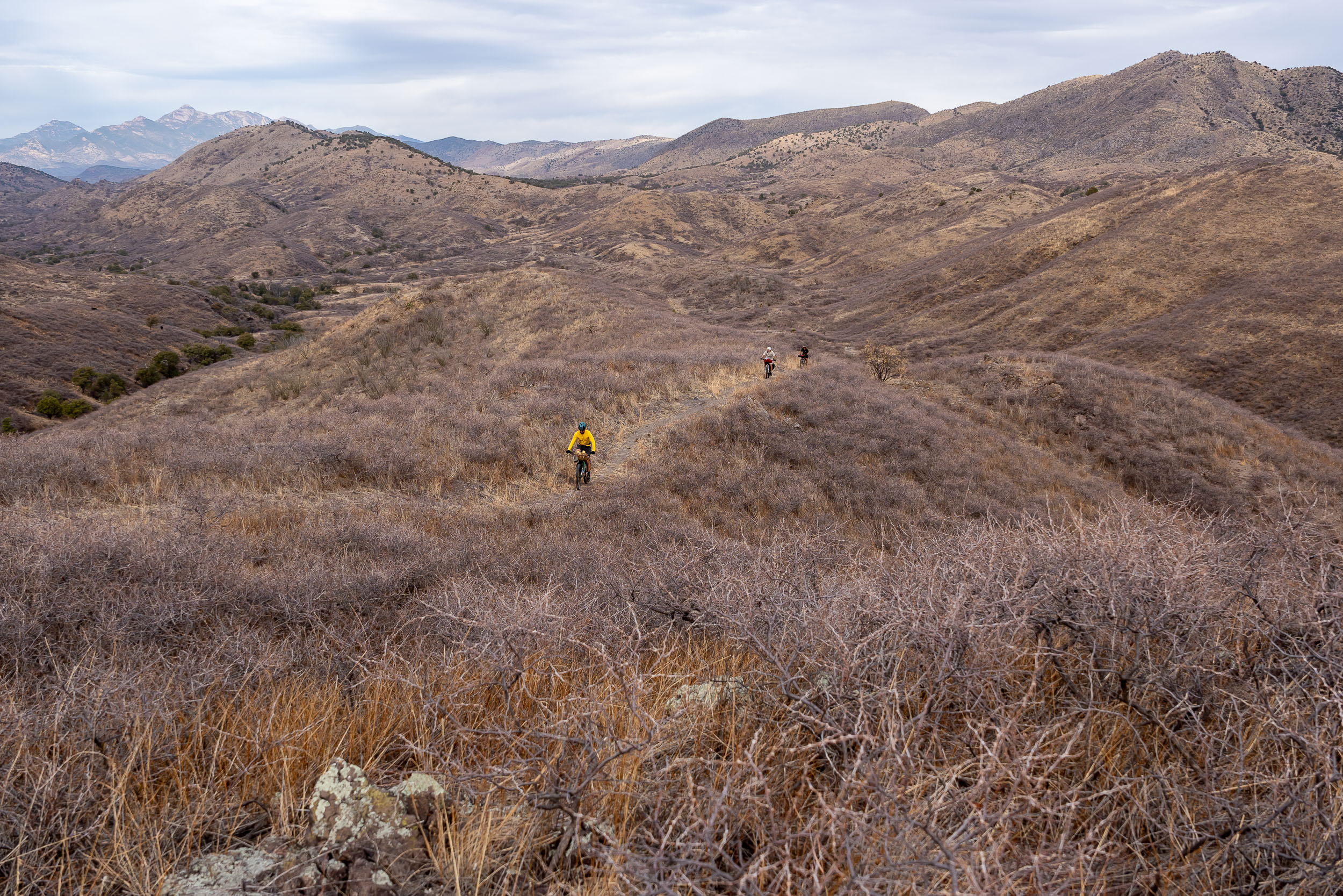
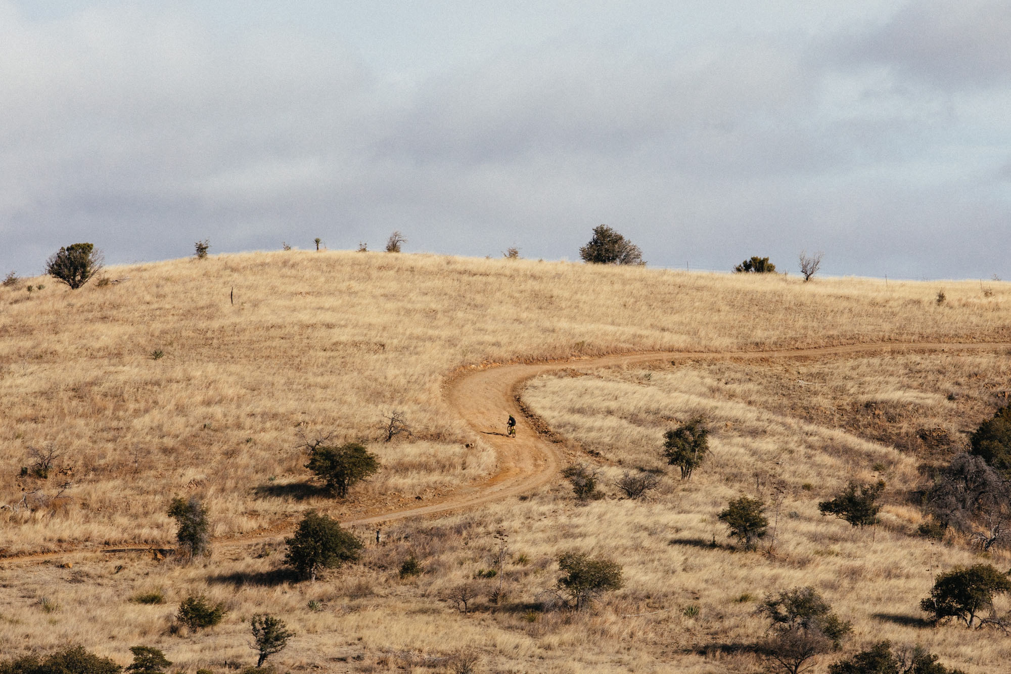
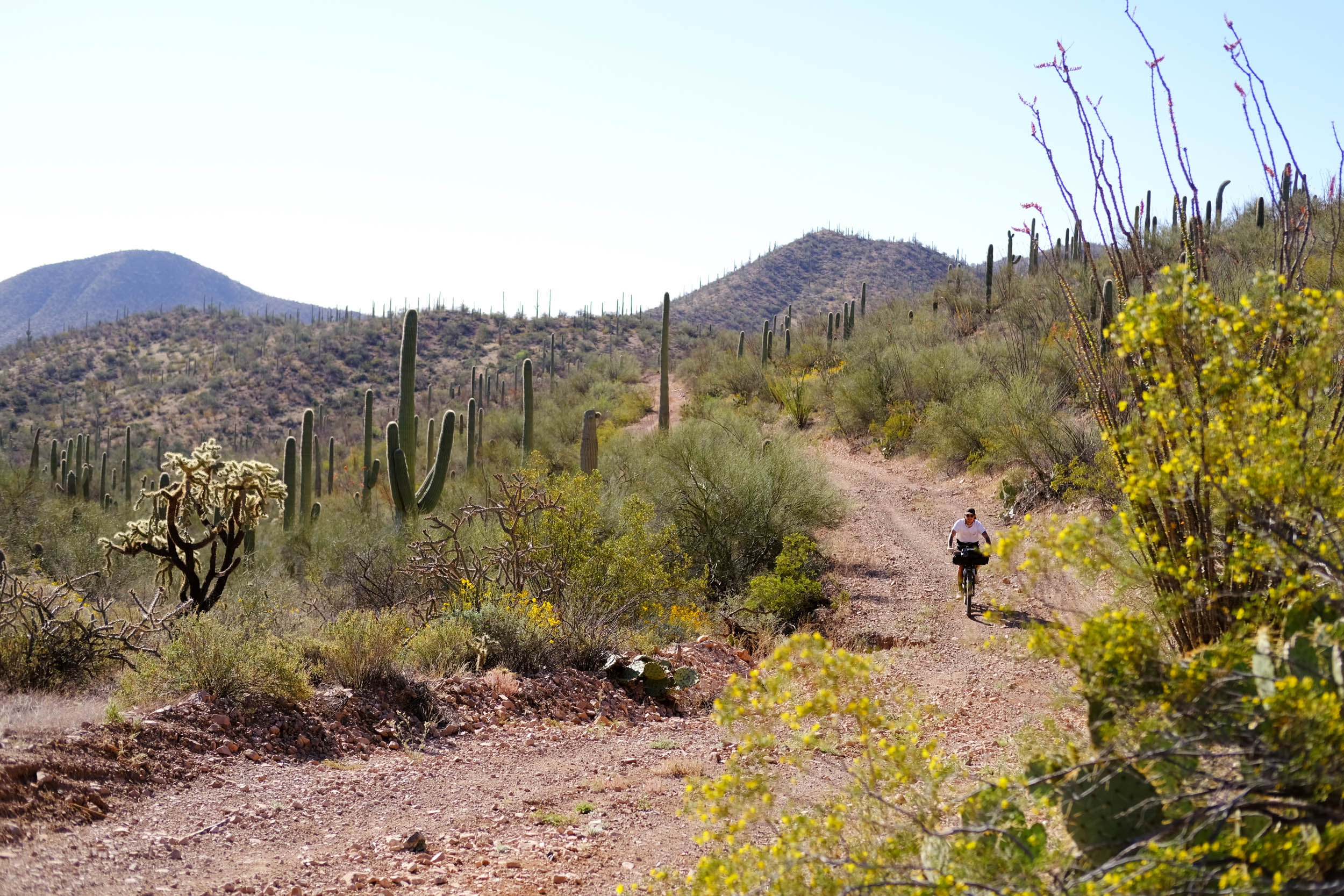
This route heads out of town on a network of bike lanes, takes a tiny taste of some local mountain bike trails, and then visits Saguaro National Park. From there, find hard miles on the Arizona Trail, variously twisty and bumpy and up and down punchy. For those couple of days you will settle into a singletrack that uncoils toward the mountains ahead as you pedal south. It’s never unmanageably technical, but it demands attention and sharp skills to weave through rocks and uneven steps or loose, chattery turns.
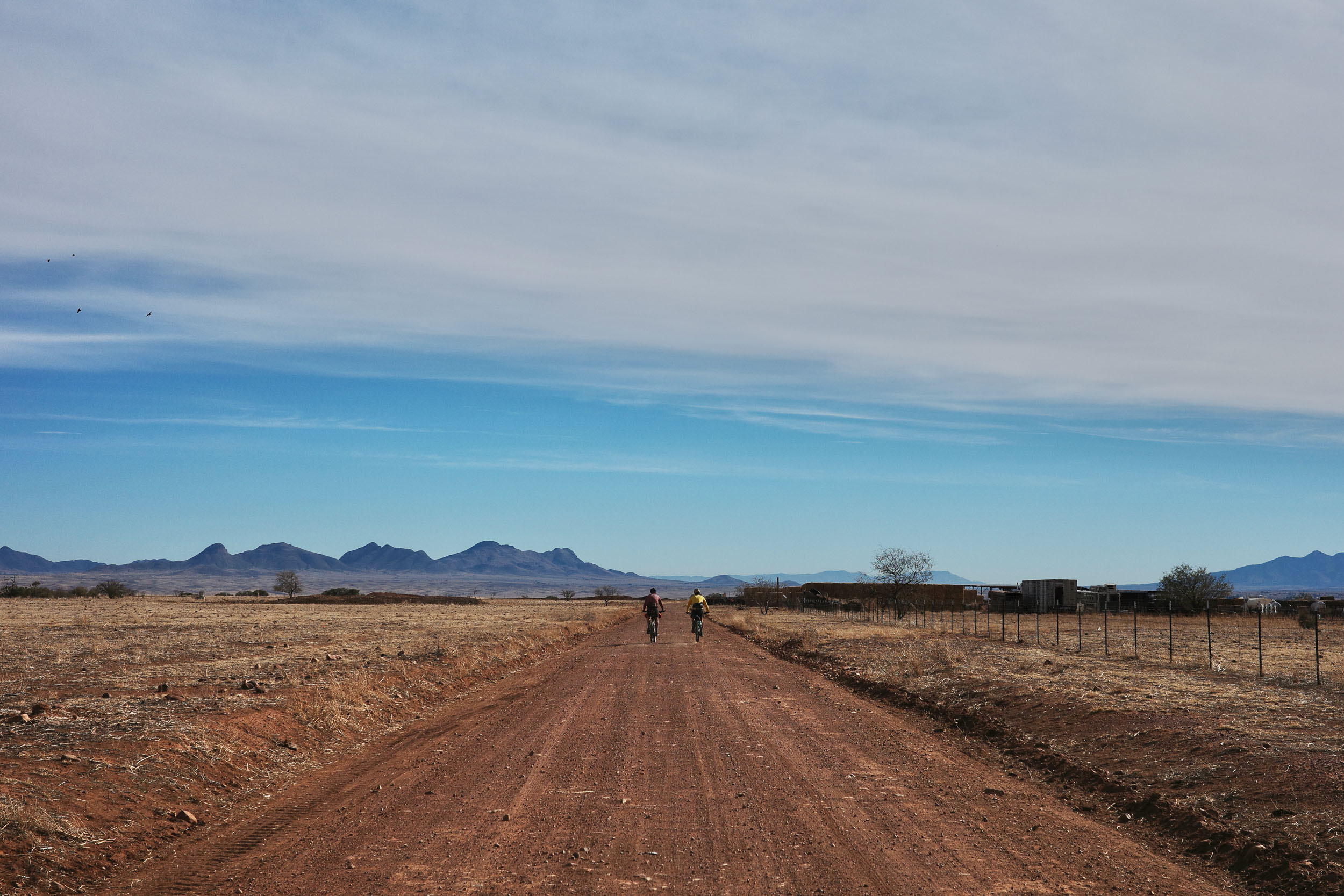
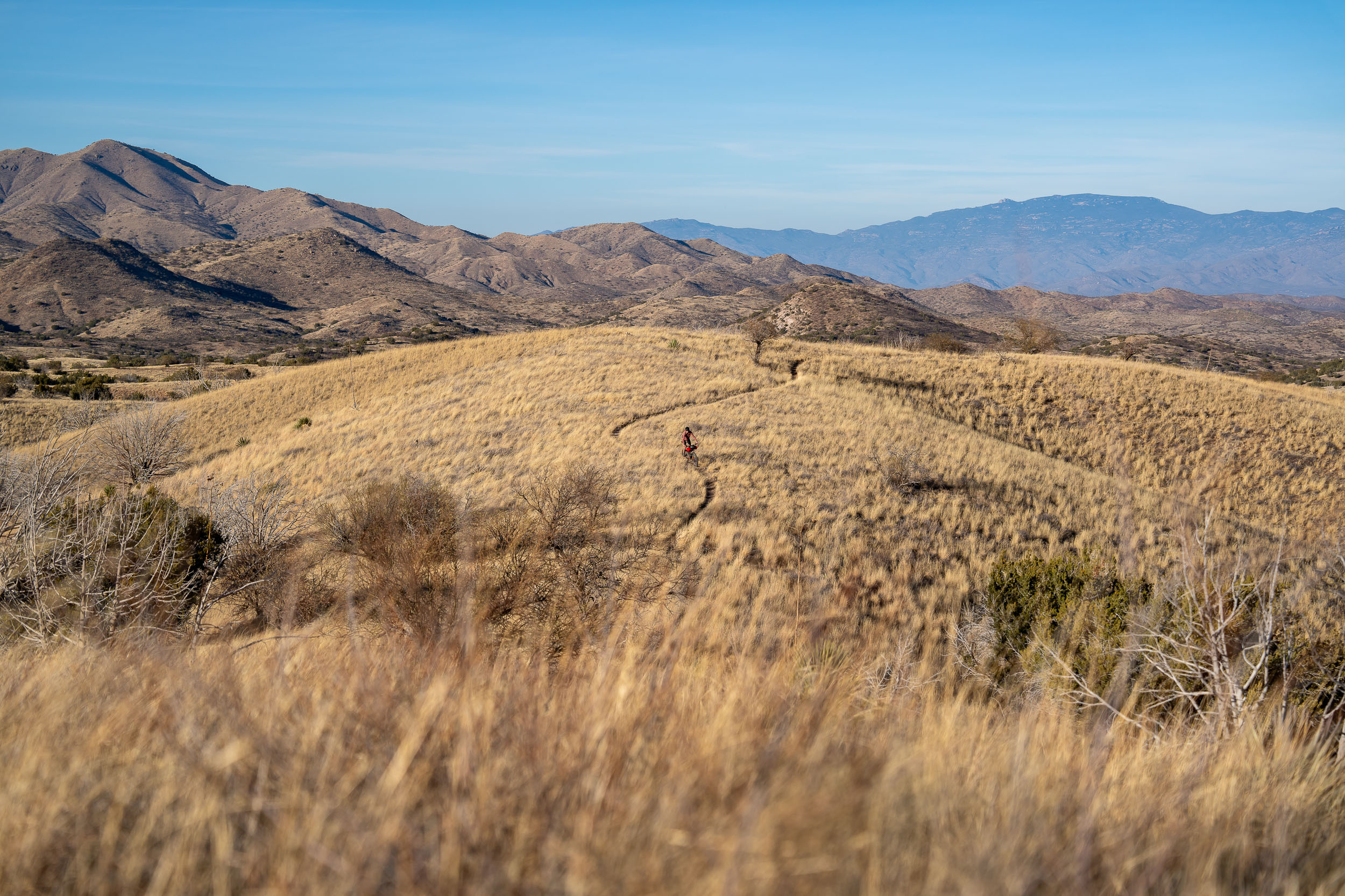
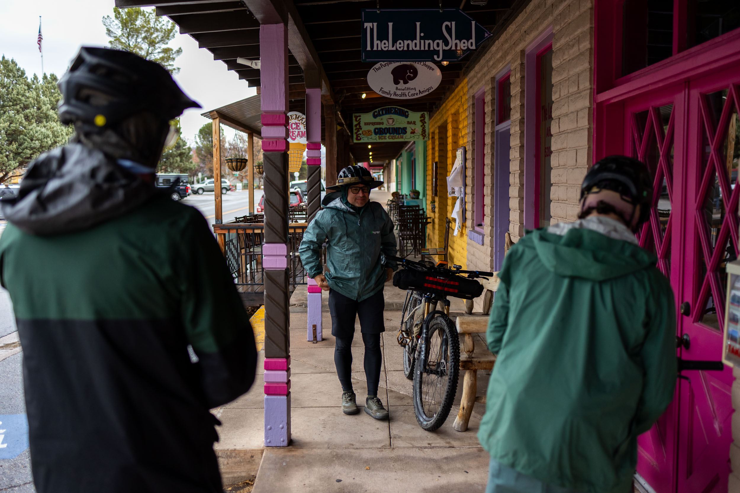
The AZT slowly, almost eluding notice, joins waving grasslands below Sonoita. Soon the ride sees a dramatic transition to the champagne dirt roads that have made Patagonia, Arizona, rightly famous for gravel riding. Indeed the route passes right through Patagonia, one of several resupply points and an occasion to sip a beer, enjoy some of the local bicycle culture, and eat a good meal. That middle part of the ride gives a sense of vast openness. There are cows and javelinas on the range, stately cottonwoods marking the seasonal streams, clouds that scrape the top of the sky and turn burning pink in the last hour of the day. You’ll get a long stone’s throw from the Mexico-US border. There’s no ludicrous fence or visible conflict just here, but the border is still a real presence saying something worth thinking about regarding our politics and history.
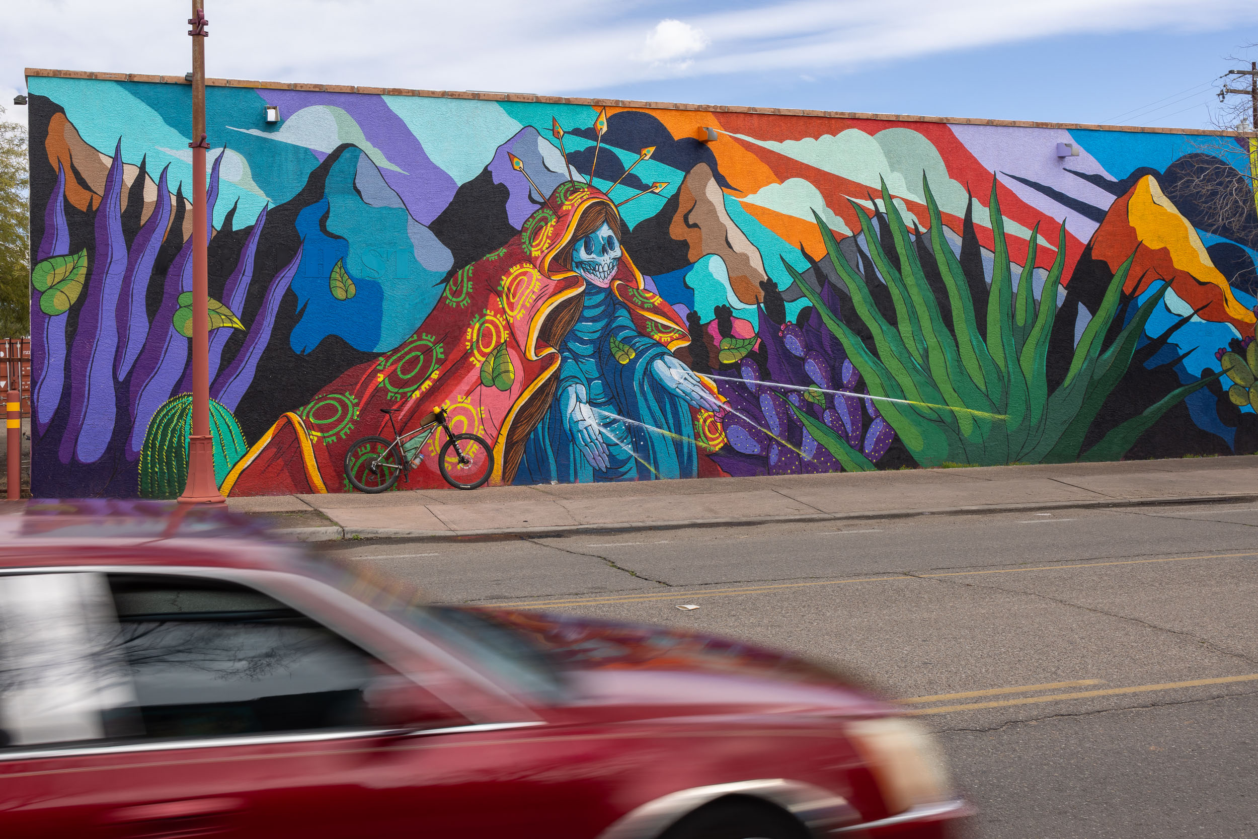
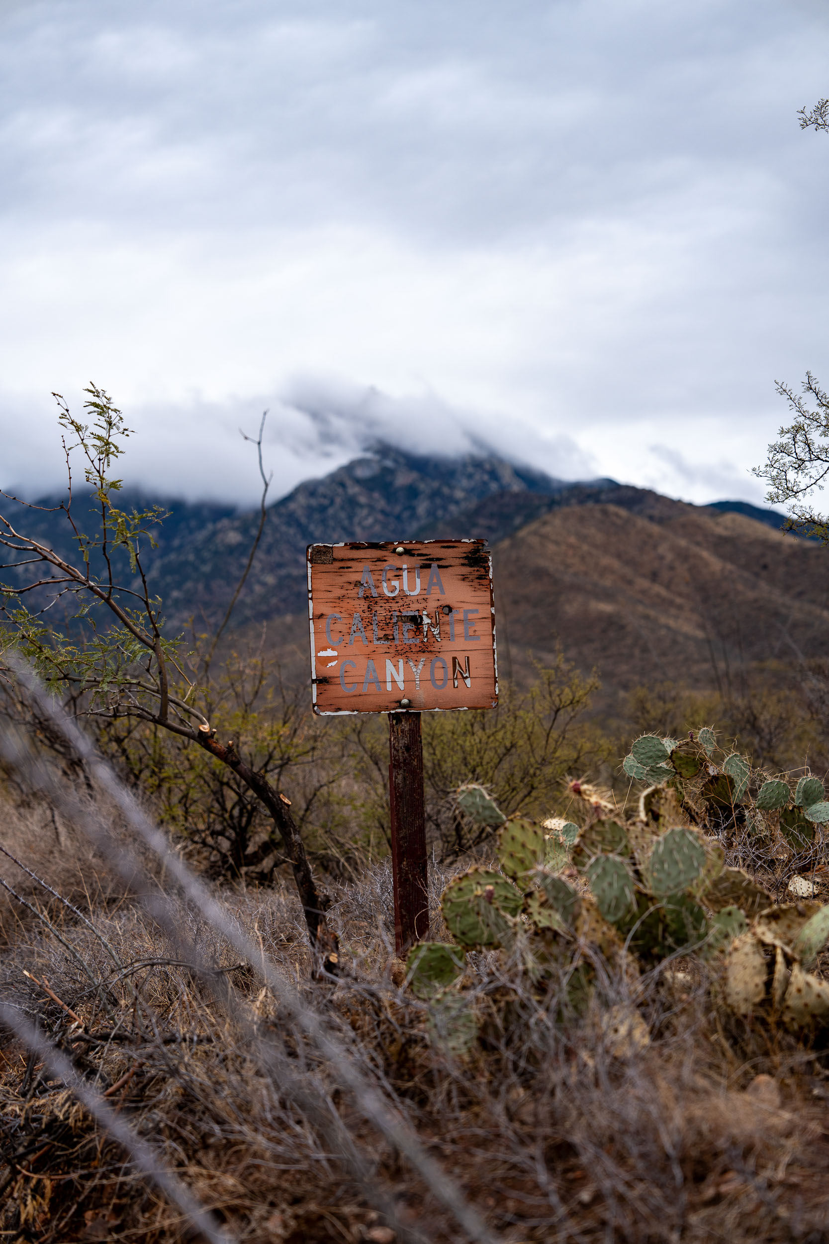
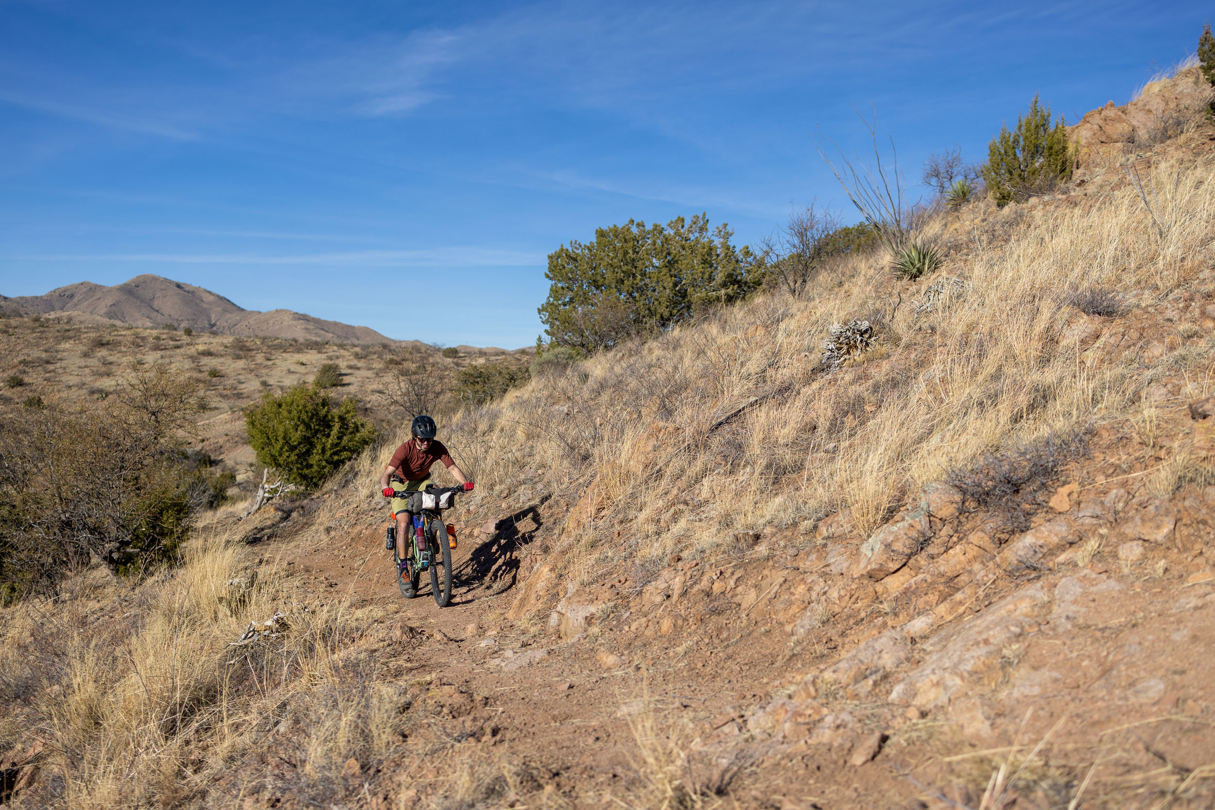
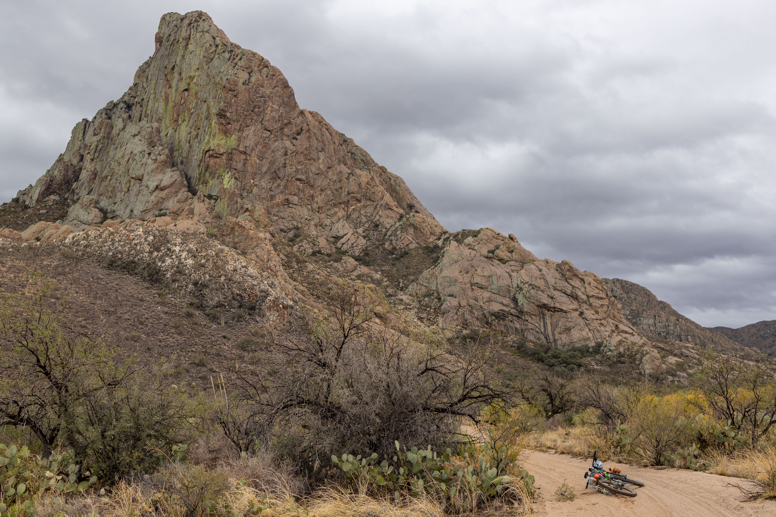
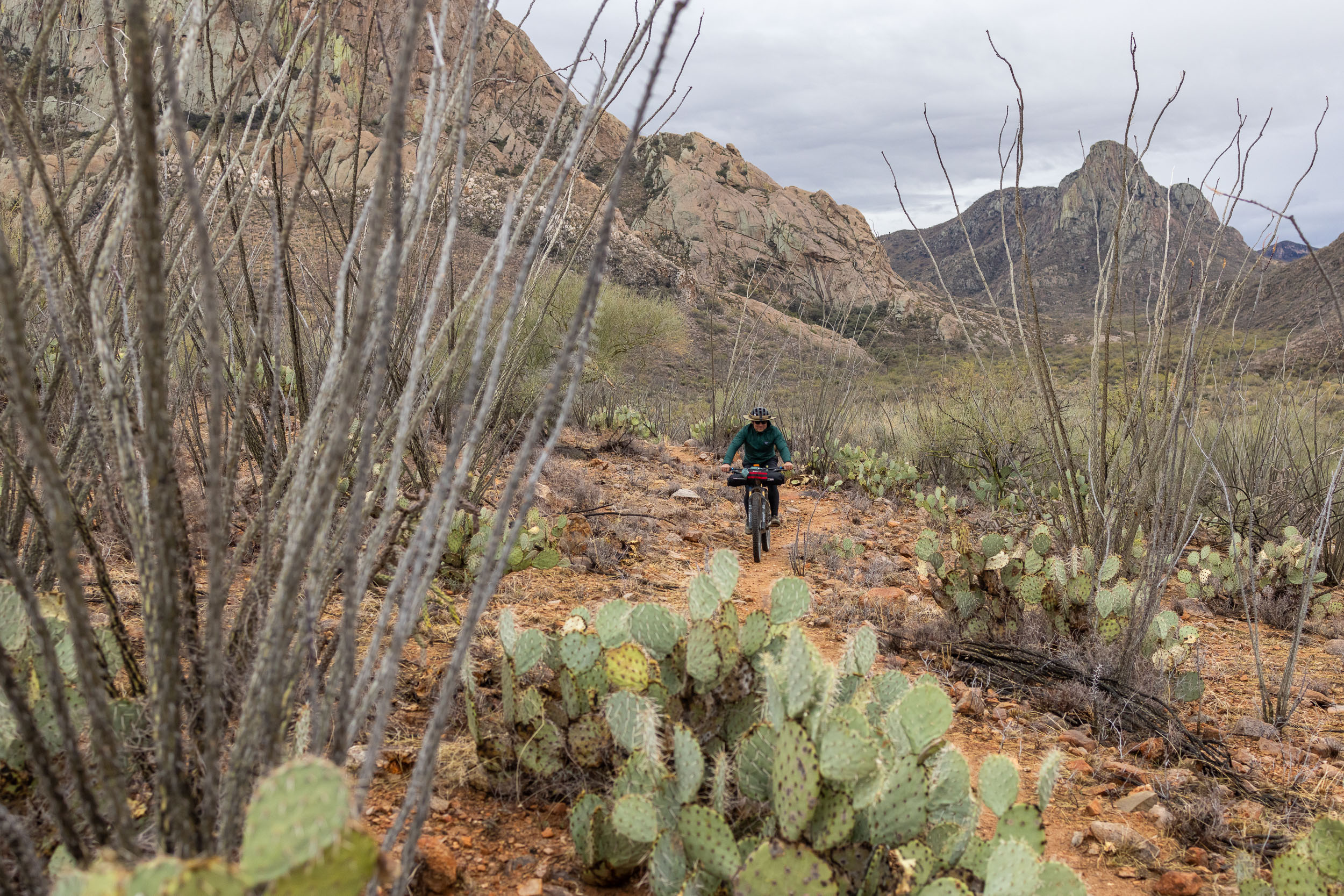
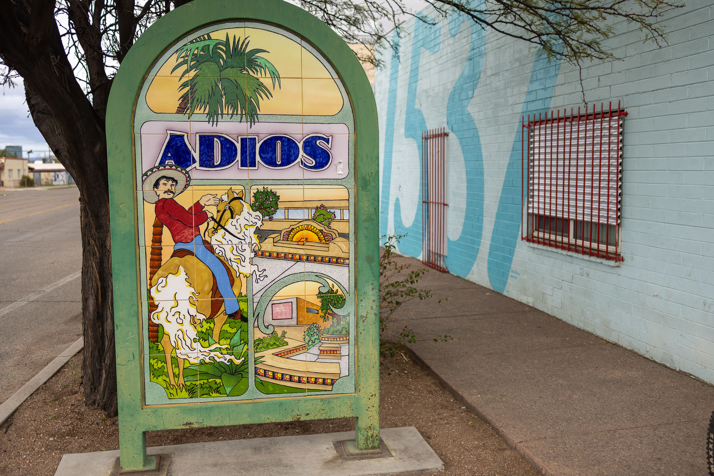
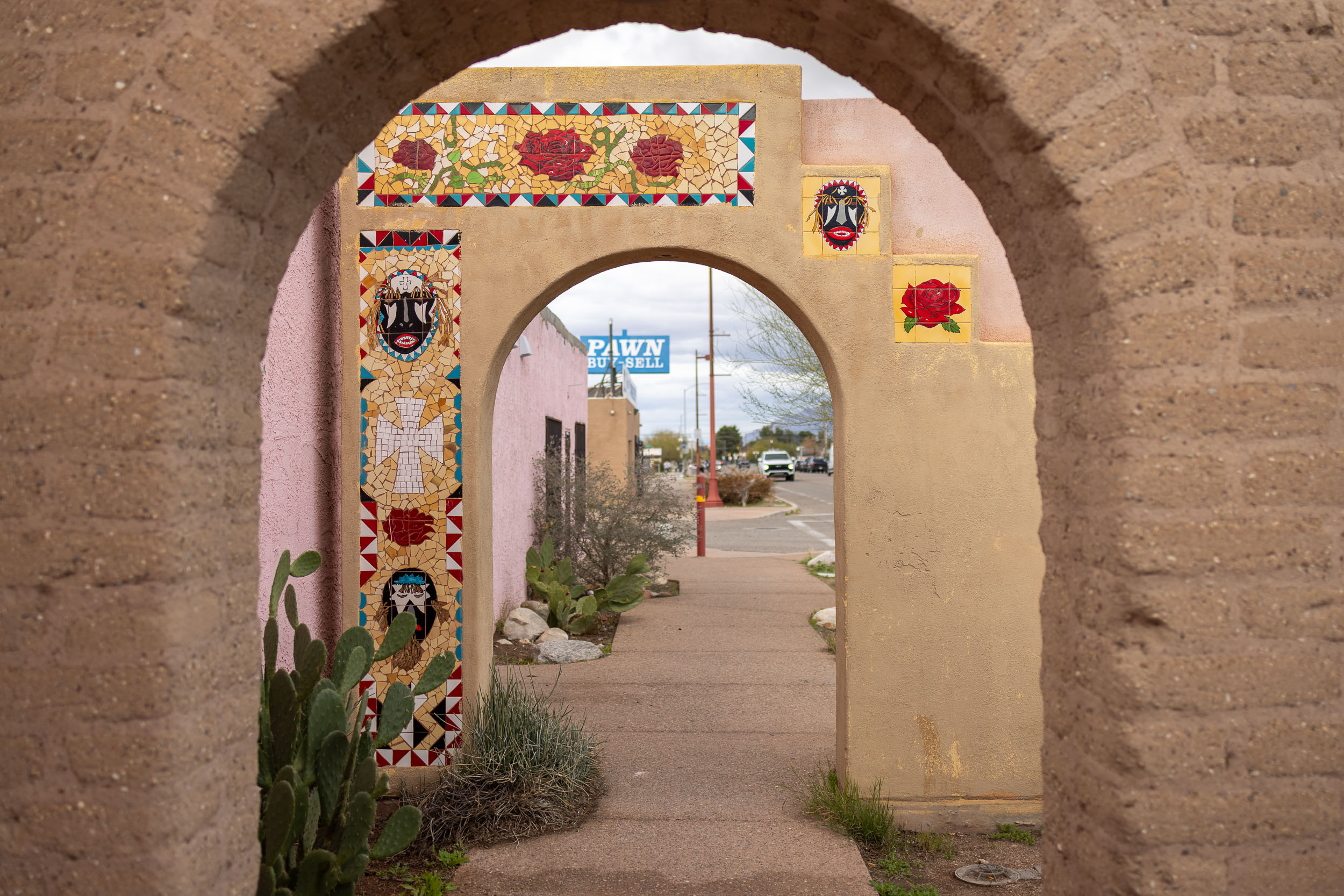
After Patagonia, the track tacks around the Santa Ritas proper up Solero Canyon and in sight of the majestic Elephant Head Butte. You’ll start to see saguaros again as you come around to Madera Canyon, with a return to hours of singletrack threading through cactus stands. There is at least one more chance to sleep outside before a straight line north back to the city through the University of Arizona’s Santa Rita Experimental Range. There are, admittedly, a few unattractive miles of highway on that final approach, but the shoulder is ample and you’ll forget it soon enough when you’re back on Tucson’s extensive bicycle infrastructure. The ride ends with a passage through the vitality of South Tucson’s 4th Avenue with its murals and mosaics and some of the best Mexican restaurants in the state (you’ll also pass right by this author’s old apartment from my 1990s graduate student days). Leaving South Tucson, you’ll reach downtown and then commercial 4th Ave with bars, more restaurants, and—when the University is in session—a humming bustle.
In all, the route tries to make accessible what so many of us have found compelling about Southern Arizona. There is a sense of remoteness, the unique challenges of arid country travel, the peaceableness of the desert, a spiritual expansiveness.
DIFFICULTY
There are two main challenges on this route, namely sustained hard hilly singletrack and water management.
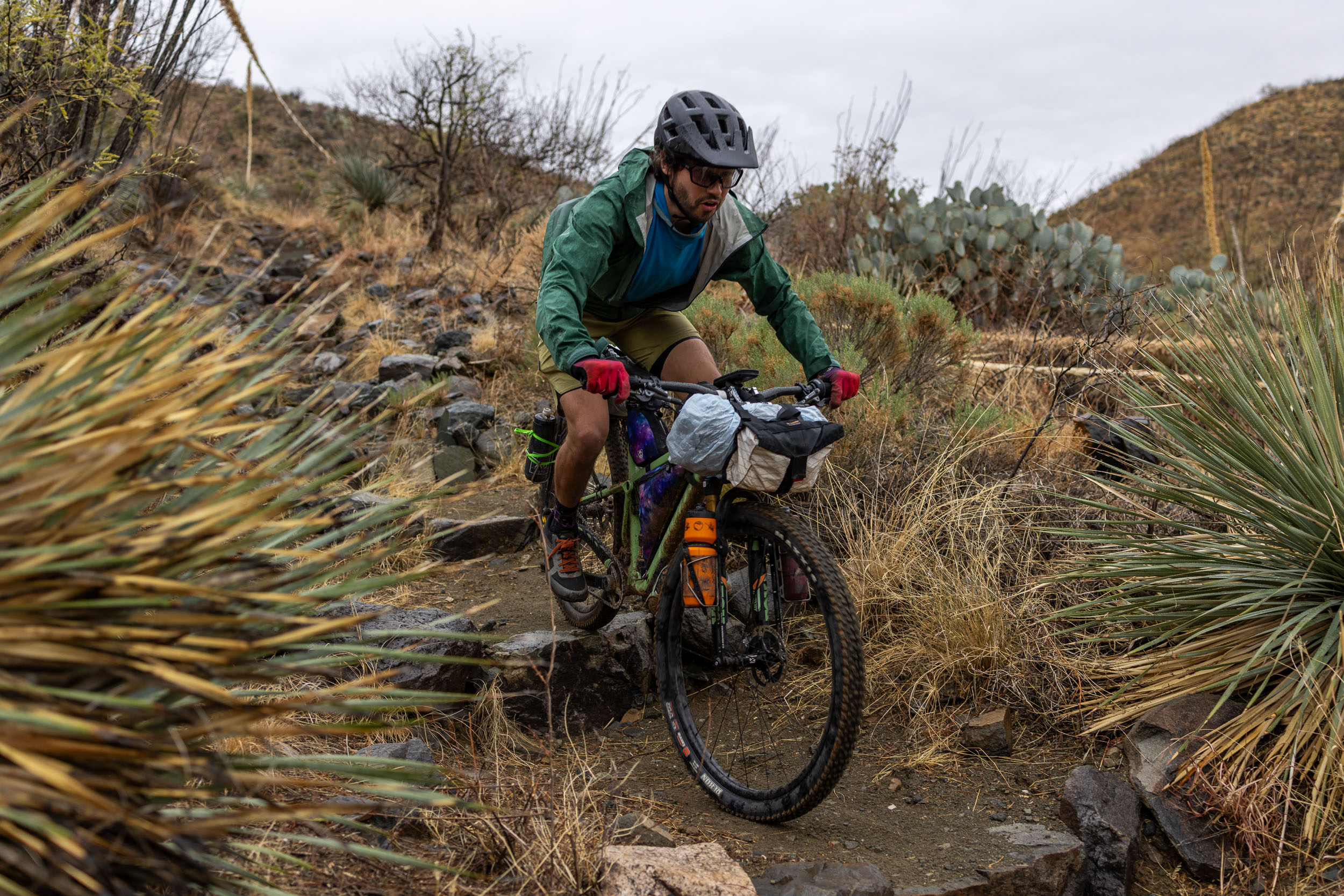
Nearly a third of the loop is on narrow tracks that are rocky, loose, and often steep. For an experienced mountain biker, all of these sections are rideable and within ready reach, but confidence and technique are required. This is not appropriate for those just starting out with bikepacking, and you will want to have many trips under your belt before heading out. Even strong riders who mostly ride gravel and forgiving flowy singletrack will find the AZT a challenge.
The other two thirds of the loop are on beautiful gravel, dirt mountain roads, and tarmac (often bike paths) to get in and out of the city. So it’s not an unforgivingly difficult circuit. There is a huge variety of terrain overall.
In terms of water management, you will want to have a very solid grasp of your needs and how to safely conserve water, ideally along with some experience with dealing with hydration in the desert. In winter, we suggest being able to carry at least four liters of water, and you’ll want to top off whenever you get a chance. In the warmer months of April-May and October-November you’ll want to carry even more, and perhaps even cache water if you can (see the Food/H2O tab below). This route is not recommended to ride June through September unless you are a very seasoned extreme weather traveler. Do not underestimate the Southern Arizona sun. It is routinely 100°F (38°C) in these months.
We’ve assigned this route an overall difficulty of 7. Much of it is not quite that demanding, but this number should signal that there are sections and challenges that one needs to be clear-headed about.
ROUTE DEVELOPMENT
A team of us scouted this loop as one continuous trip in January 2024. Virtually all of the components of it are familiar pedaling grounds for Tucsonans and frequent visitors to Southern Arizona, so substantial credit should go to the generations of riders and mountain bike clubs that have shared their wisdom. Though the track has changed a bit over the decades, I rode the Arizona Trail and many of the dirt roads around Sonoita and Patagonia when I lived in Tucson in the 1990s and rode with SAMBA. We also often sought out the trails near Elephant Head Butte and did rugged day rides on the west side of the Santa Ritas. This circuit represents one way to link all those highlights together into a single week-long trek.
Special thanks are due to Sarah Swallow, who showed me several newer sections of trail in the Santa Rita range. There is about 40 miles of overlap between this route and her Sky Islands Odyssey East Route (find link in the Further Riding grid at the bottom of the page). A circumnavigation of the Santa Rita section is often done on its own, and this website has in the past featured such a stand-alone route by Eszter Horanyi.


Submit Route Alert
As the leading creator and publisher of bikepacking routes, BIKEPACKING.com endeavors to maintain, improve, and advocate for our growing network of bikepacking routes all over the world. As such, our editorial team, route creators, and Route Stewards serve as mediators for route improvements and opportunities for connectivity, conservation, and community growth around these routes. To facilitate these efforts, we rely on our Bikepacking Collective and the greater bikepacking community to call attention to critical issues and opportunities that are discovered while riding these routes. If you have a vital issue or opportunity regarding this route that pertains to one of the subjects below, please let us know:
Highlights
Must Know
Camping
Food/H2O
Trail Notes
- Tucson itself, a culturally and historically fascinating big city that exhibits everything that is great (and complicated) about the Southwest USA.
- Riding a short bike-legal section of Saguaro National Park surrounded by incredible stately Saguaro cactuses.
- A generous helping of the rugged, challenging, and satisfying Arizona Trail.
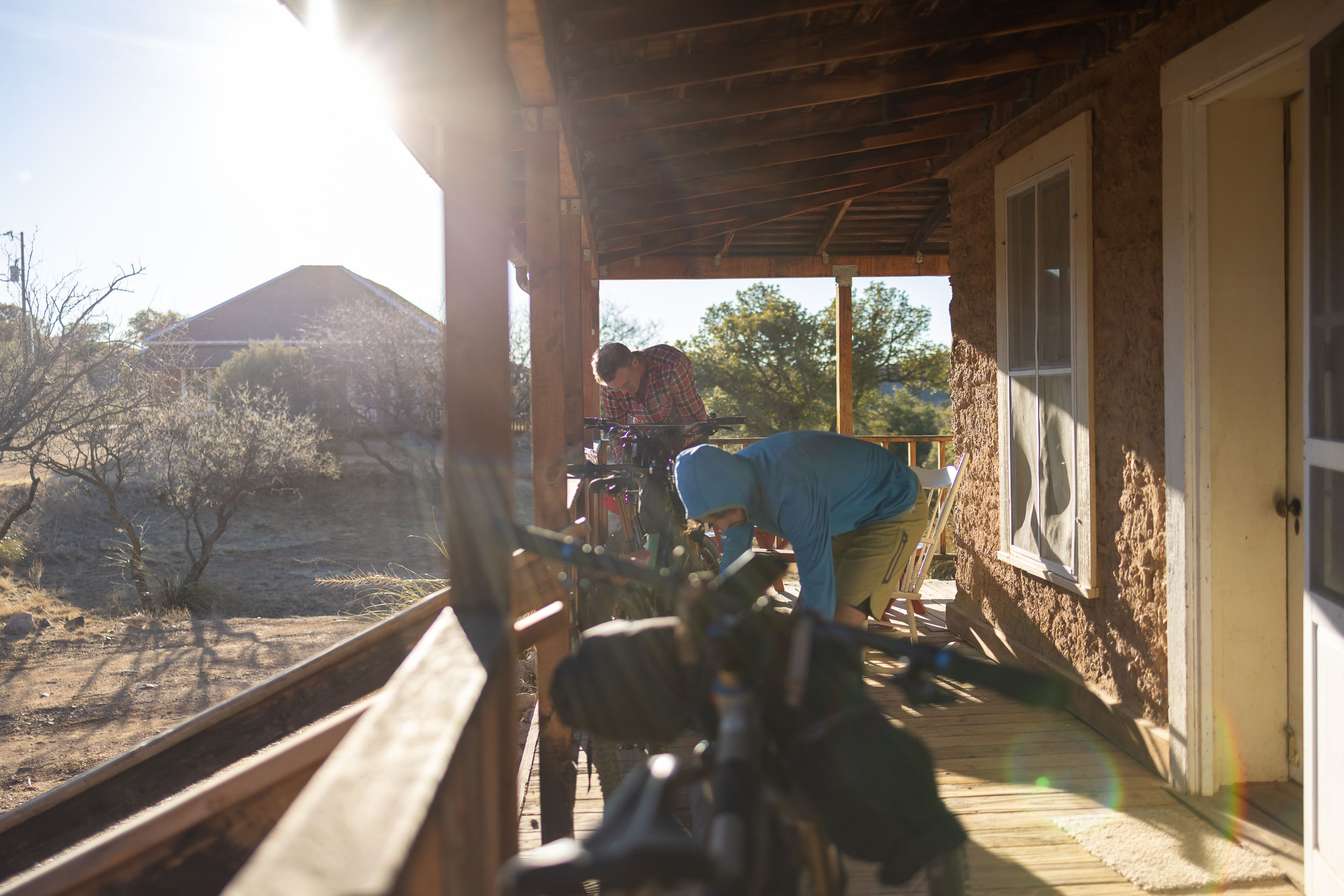
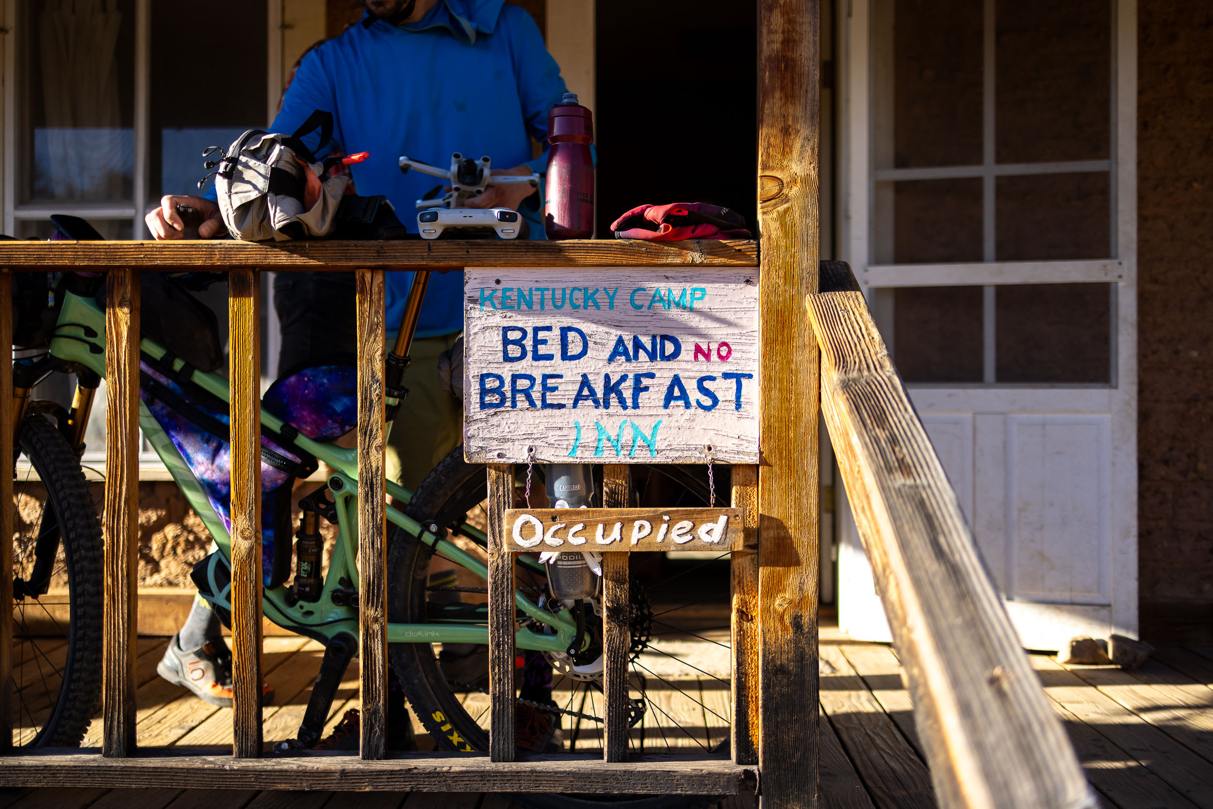
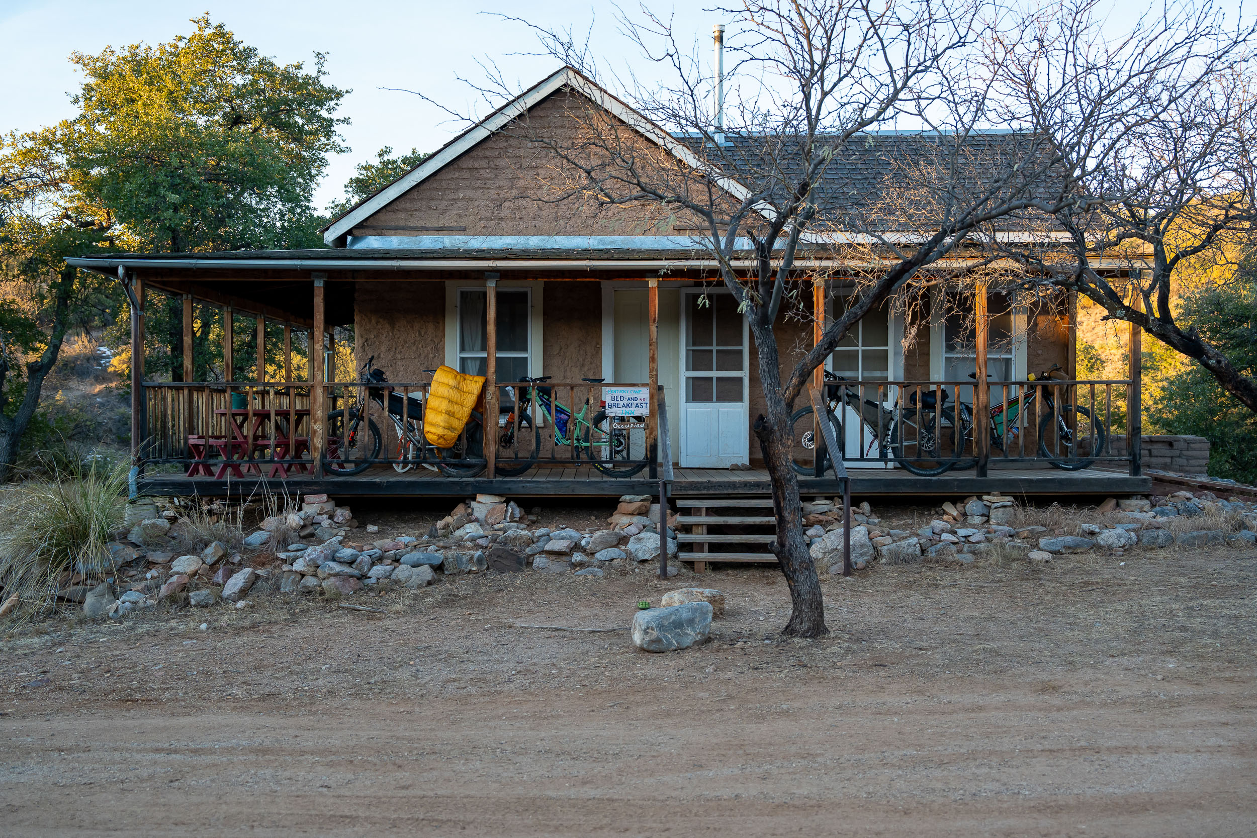
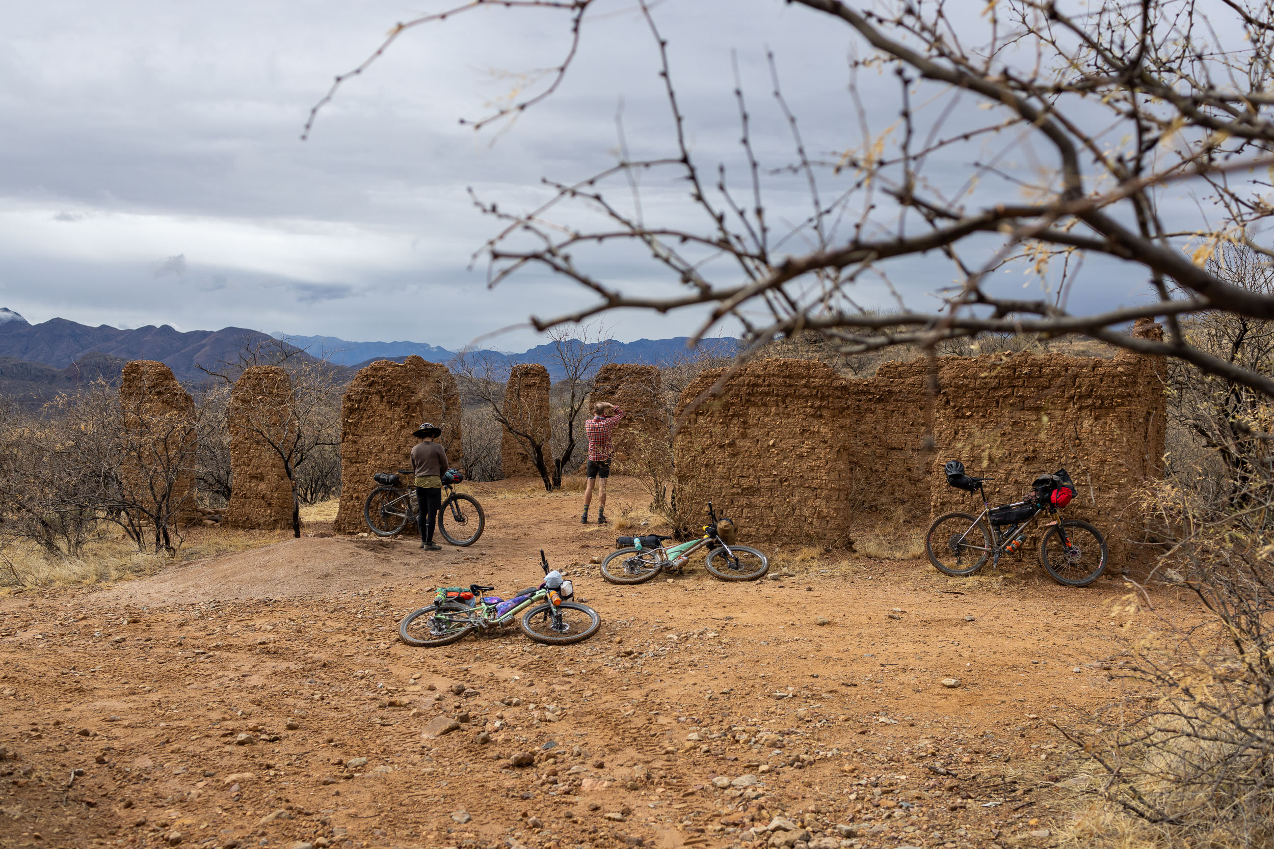
- Kentucky Camp. Originally a mining camp and then a ranch, Kentucky Camp is now administered by the US Forest Service with the possibility of spending the night in the single historic camp cabin.
- Grasslands surrounded by sky islands.
- Champaign gravel roads near the Mexico/US border and visiting abandoned towns like Lochiel.
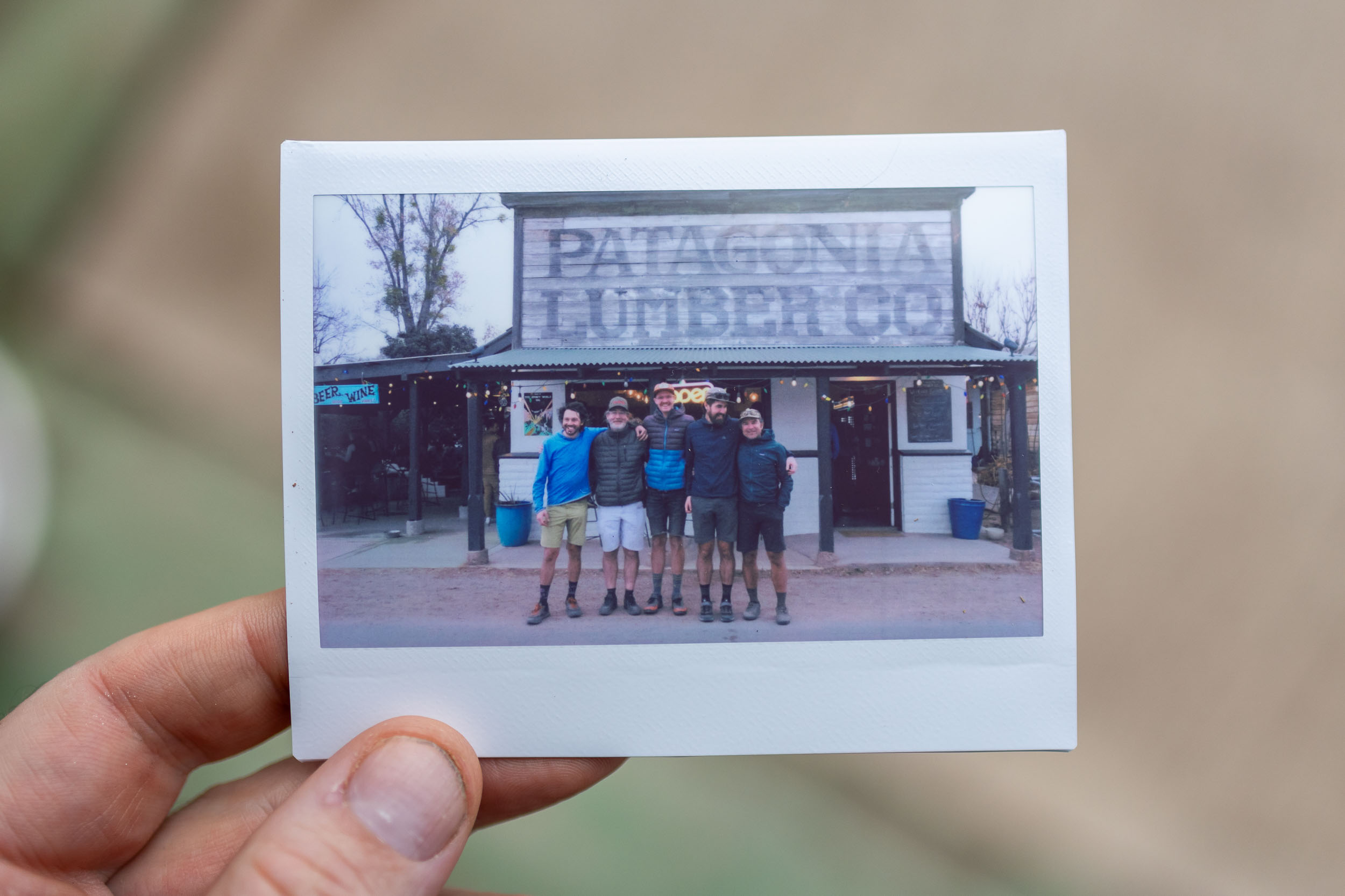
- Patagonia, a quirky little town that has become the epicenter of gravel riding in the desert Southwest.
- Salero Canyon, a long gradual ascent along the shoulder of the Santa Ritas that takes in a range of biozones.
- Riding in the shadow of Elephant Head Butte.
- A finale along South Tucson’s historic 4th Avenue with murals and lively community life, then downtown Tucson and a vibrant commercial area near the University of Arizona.
- When to Ride: The best time of the year for this trip is late October through early April. The nights in January and February will be notably cold and could drop down to freezing at the higher elevations, but in general those are quite nice months in Southern Arizona. The intense heat of late spring, summer, and early fall will make this ride challenging. If you choose to travel during this hot season (which is not recommended), have a very solid water management plan, seek shade when available, and dress appropriately with covered skin and a wide-brimmed hat.
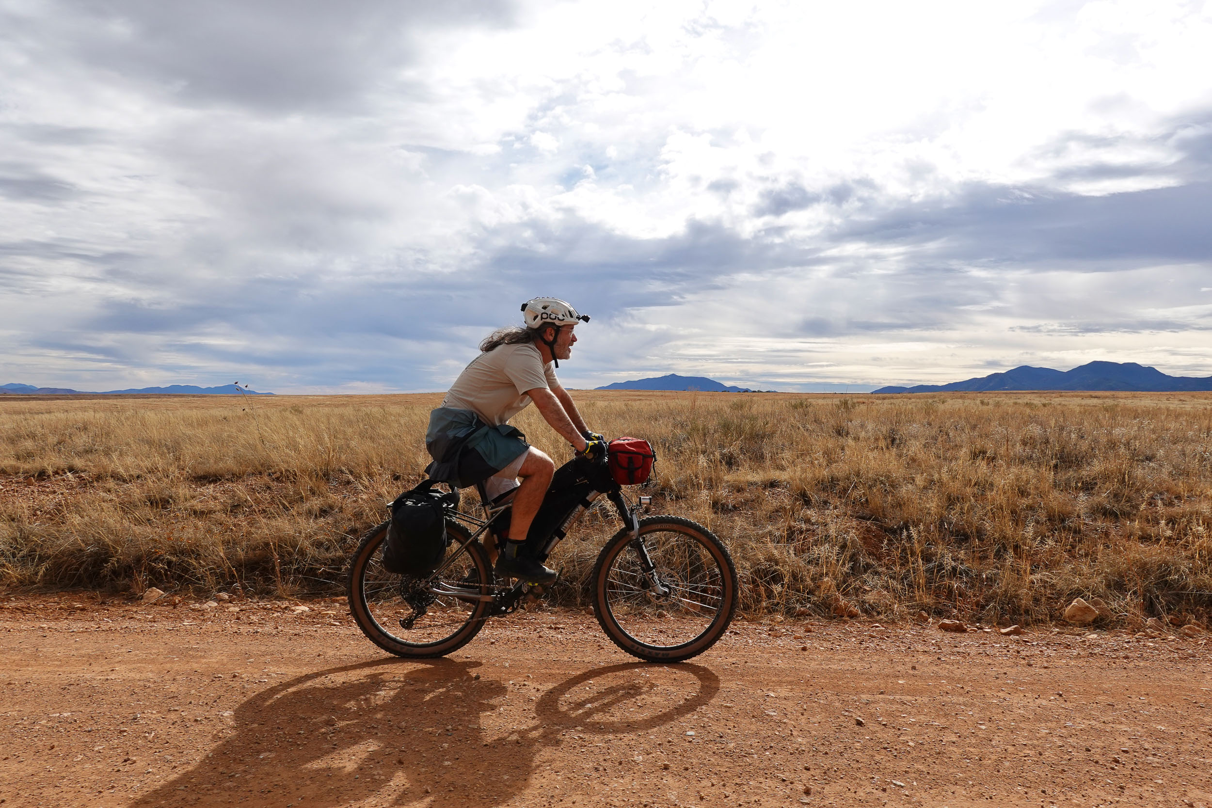
- Ideal Bike: The ideal bicycle is a hardtail with 2.2” tires or larger. A full-suspension bike would also be an excellent choice, assuming enough luggage capacity and pedalability on the long dirt road sections. A plus-tired rigid bike in capable hands would work. Don’t ride a gravel bike. Anything is doable with enough stubbornness, but riding a gravel bike will most likely be an unhappy experience on the AZT sections of this route.
- Tubeless or misery. A proper tubeless setup, plugs, extra sealant, and a sewing kit are musts.
- Bike Shops: Tucson has numerous excellent bike shops. Two that we especially recommend are Campfire Cycling, specializing in bikepacking bikes and accessories, and Transit Cycles, a woman-owned shop with friendly expert wrenching and advice.
- Cactuses! Pro tip: add a small plastic comb to your first-aid kit to use to pry off cholla cactus arms should they embed in your skin or clothing. Obviously, tweezers should be in that kit, too.
- Wildlife: The Arizona animals that are most concerning like rattlesnakes, scorpions, and poisonous spiders are not likely to be an issue during the months that it is most sensible to ride this route. Still, be mindful of the possibility of encountering these and other creatures that will work vigorously to defend their small patch of desert. Note that javelinas, while adorable, are quite cantankerous, so don’t antagonize them. Move slowly and predictably around cattle on the track. On the other hand, don’t frighten yourself with overblown concerns about the desert fauna. In the near-decade that I lived in Tucson and countless days in the backcountry surrounds, I frequently encountered all of these animals and not once had a problem.
- Route Direction: We scouted this loop in the clockwise direction. It would certainly be doable counter-clockwise. In fact, the mileage on the Arizona Trail north of Kentucky Camp would be much easier in that direction, since it trends downhill. We still recommend clockwise, however, because it front-loads the hardest singletrack when you are freshest, and it more quickly gets into a scenic area that will be exciting and interesting.
- Patagonia Bikes is a small bike shop in Patagonia behind the Lumber Co. pub. Their hours and stock are understandably limited, but they have a knowledgeable mechanic and may be of help in a jam when you’re far away from the shops in Tucson.
- For those flying into Tucson International Airport and riding straight from there or a nearby hotel, here is a simple connection that will link you back with the main route, just south of the Fantasy Island Trails.
- If you need camping supplies before heading out, visit The Summit Hut, Campfire Cycling, the Goodwill on 4th Ave, or Miller’s Surplus. The latter three are reasonably convenient to the start of the route if you don’t have a car.
- There are four established campsites along the route, and they are marked on the map.
- Bosquecito Campground at Colossal Cave. Sites are first-come, first-served, and you may pay for the site at the Colossal Cave visitor center, which is approximately one mile from the camp area. It is open from 8 a.m. to 4 p.m. seven days/week (closed Thanksgiving and Christmas day). If you arrive after 4 p.m., there is often a caretaker/maintenance person at the campground who can be paid directly. Finally, you may phone the visitor center—again, during their opening hours—and pay by credit card. Colossal Cave aims to put into place a more robust electronic reservation system, but at the time of this writing, it has not yet been launched.
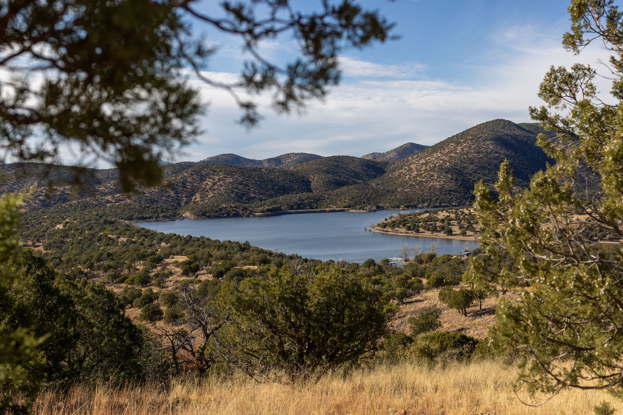
- The campground at Parker Canyon Lake is an RV-centric campground near the marina.
- TerraSol Campground in Patagonia is a private, in-town small campground serving hikers, bikers, and van campers. Friendly, great facilities, and highly recommended.
- Bog Springs Campground at Madera Canyon is a first-come, first-served US Forest Service campground.
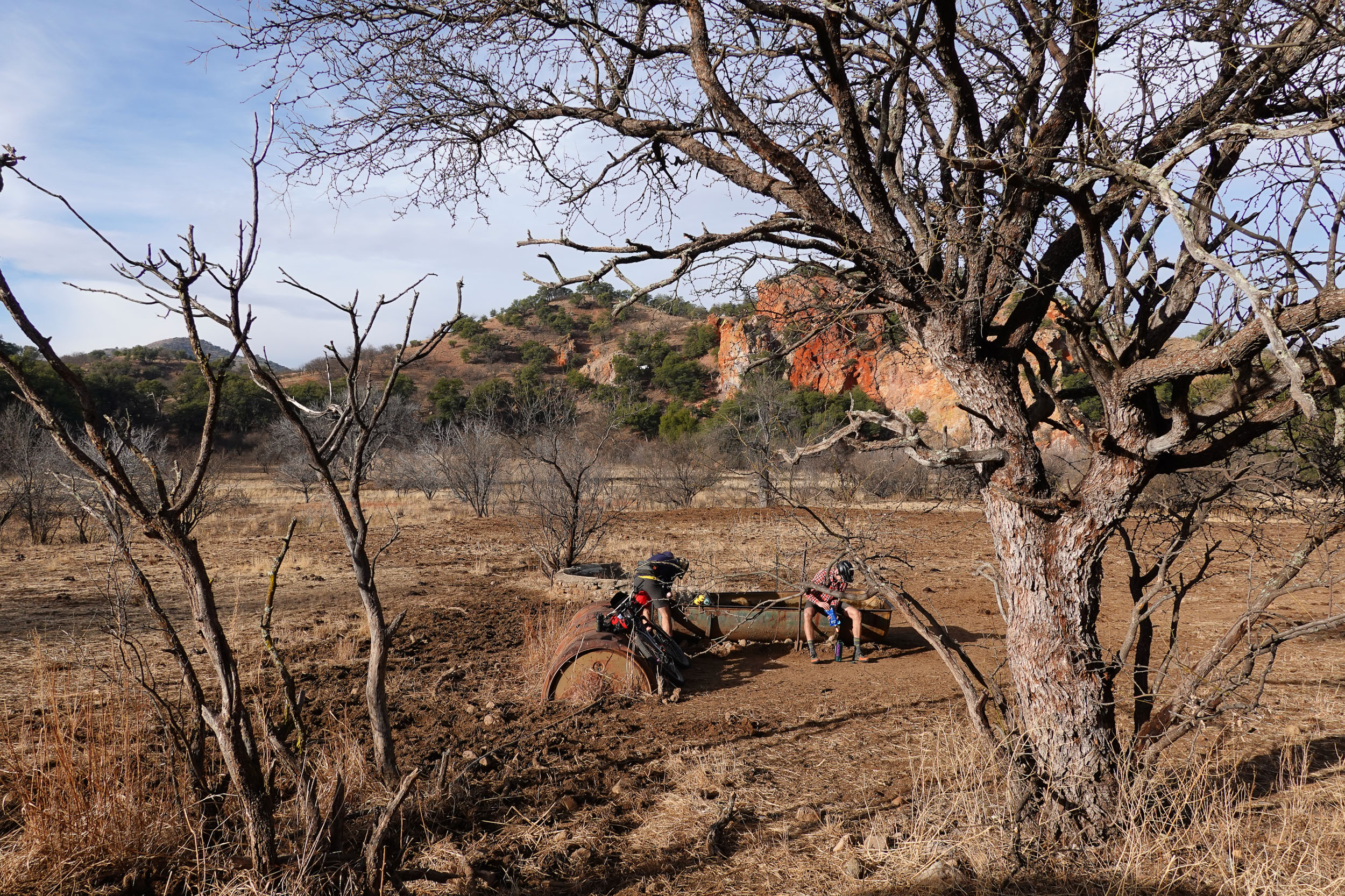
- In general, camping for one night along the Arizona Trail is legal. Do not, however, camp within 200 feet/65 meters of a natural water source, as this may discourage animals from visiting that source while you are there. For cattle tanks and other human-made water sources, do not situate your camp closer than a half mile/1 kilometer, again out of deference to the stock and wild animals that rely on those sources for survival. Please practice a strong leave no trace ethic.
- Kentucky Camp (marked on the map) is a neat spot with a museum, a picnic area, historic buildings, and a cabin. Lodging at the cabin can be reserved. In the cabin, there are five beds—you’ll use your sleeping bag, as no linen is provided—electricity, cooking tools, and heaters. Even if you can’t stay at the cabin, it’s worth a visit to the camp to linger for a bit. There is dispersed dry camping with a pit toilet near Kentucky Camp. Go to the camp itself to top up bottles.
- On other parts of the route, there are frequent opportunities for dispersed camping.
- Hotel lodging options can be found in Sonoita, Patagonia, and Madera Canyon. Aim to make lodging reservations and check-in arrangements as much in advance as possible, because not all hotels in this area have a front desk that is staffed all day. Also check AirBnb and Hipcamp.
- Rocking K Market, before going into Saguaro National Park and a more sparse resupply zone, is a great stop with a grill, deli bar, beer taps, and provisions.
- Outside of Tucson, there are proper resupply options in Sonoita and Patagonia, including several restaurants and general stores.
- Sonoita boasts numerous venues for wine-tasting and is home to the Copper Brothel Brewpub.
- Parker Canyon Lake Marina has a small general store, but hours are limited during the winter, and you can expect to pay a premium for everything.
- Patagonia Lumber Co. pub is a must-visit with a fun vibe that includes occasional live music and food trucks.
- Finding water sources between towns is perhaps the biggest challenge of the route. There are some water tanks that can be filtered from, and the occasional creek will present itself after rainfall. Make sure you can carry enough water and bring a filter.
- Several trailheads have cache lockers where thru-hikers leave water and supplies for their trip. Hopefully needless to say, do not steal their caches! Trail volunteers also sometimes leave water jugs for thirsty trail users. These are usually marked “public” or in some other way as to distinguish them from the ones intended for a particular hiker. Do not expect to rely on the cache lockers to fill your bottles, for at least two reasons. Firstly, you can’t know in advance that there will be “public” water at the caches. Secondly, the trail volunteers and the informal infrastructure of support is primarily meant for Arizona Trail hikers, who cannot carry as much or cover as much ground as cyclists. They can be put in a very dangerous situation if they are unable to find water. There may be a time when cycling-dedicated volunteers also step up to help stock these water cache points, but that is not the dominant situation right now. We think the best policy is to regard the water caches as by and for hikers. If it’s an emergency, no doubt anyone would understand a biker drinking the public water from the hiker cache. But take measures to not put yourself in that emergency situation. All that said, driving to the cache points before your ride and stashing water marked for yourself is absolutely a fine idea and is probably essential during the hot months. While you’re doing that, why not drop off a few extra liters marked “public” and collect some of the empty containers to recycle them back in town?
Seven-Day Itinerary
Below you will find a recommended seven-day clockwise itinerary. The daily mileage is not particularly high but represents a steady “holiday” pace for experienced, relatively fit riders. Do not underestimate the difficulty of the Arizona Trail sections. They will likely take a lot longer than you think.
location Tucson to El Bosquecito Campground
Day 1 (39 miles, 2,072 feet)
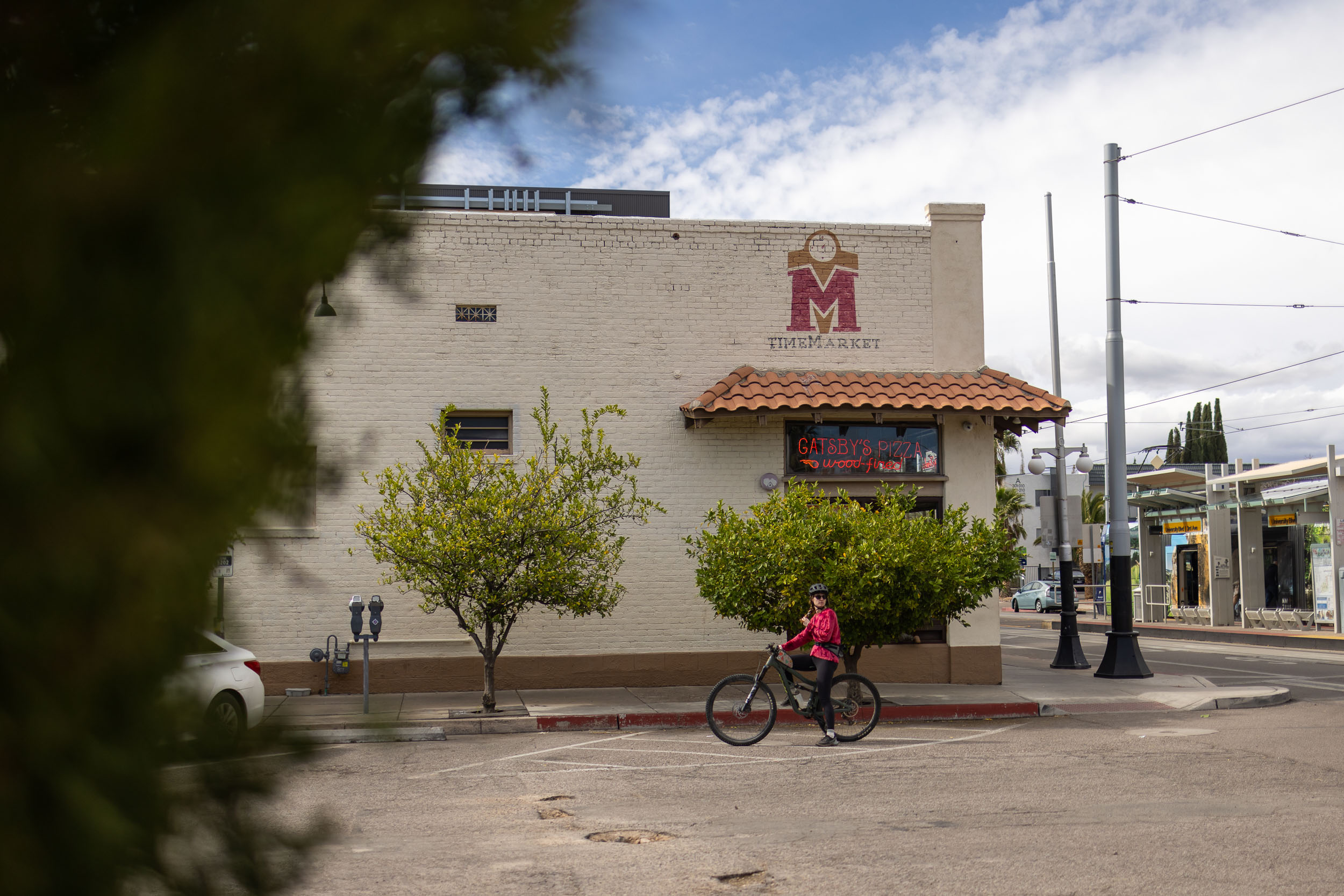
This day is short, time-wise, and allows for a late start after arriving and getting gear sorted. The Time Market starting point of the route is in a neighborhood west of the University of Arizona. It has a terrific cafe, beer taps, a breakfast and sandwich counter, and some of the best pizza in Tucson. It makes for a great launching and finishing point, but it’s purely arbitrary. Wherever you are in the city close to the route will be a reasonable place to begin. For example, if you’ve arrived to Tucson by air, here is a straightforward way to link up to the trail.
location El Bosquecito Campground to Kentucky Camp (or thereabouts)
Day 2 (42 miles, 5,437 feet)
Get an extra early start and be prepared for hard hours, as all of today is on the Arizona Trail, and the track is demanding. This is the hardest day of this suggested itinerary. Reasons to push to get to Kentucky Camp are that there is water there or if you have reservations to stay at the cabin. But it would be fine to shorten this day a bit and make up the distance on the day after (Day 3) since the going is considerably easier.
location Kentucky Camp to Somewhere on the Arizona Trail Between Hwy 83 and Canelo Pass
Day 3 (36 miles, 2,529 feet)
Early on this third day and after a long downhill, the route passes through Sonoita, Arizona. With two convenience stores, a brewery, a Dollar General store, and a number of restaurants, it is an opportunity for a complete resupply. At the very least, you should plan to leave Sonoita with all of your bottles completely full. There is a slightly annoying 7-mile/11-kilometer section of highway with traffic after Sonoita, but it trends downhill and the shoulder is safe. Once back on the AZT, make some progress toward Canelo Pass and wild camp. There are two potential water sources marked on the map through here, though do not plan to camp right at them because many animals go there to drink.
location AZT Between Hwy 83 and Canelo Pass to Somewhere on Duquesne Road
Day 4 (31 miles, 3,955 feet)
There is water and a potential resupply at the marina at Parker Canyon Lake, but note that (i) it is a steep descent to the marina and you’ll have to climb back up, and (ii) the marina store has limited hours in winter, so be sure to confirm that you’re visiting during their open hours if you’re looking to purchase snacks. The campground at Parker Canyon Lake is a plausible place to spend the night after the hard days on the AZT, but if you’re able to make it a couple of hours beyond the lake, it will make Day 5 shorter for an earlier arrival to Patagonia to enjoy its offerings. On that plan, this is another wild camp day.
location Parker Canyon Campground/Somewhere on Duquesne road to Patagonia
Day 5 (34 miles, 1,809 feet)
This is great Southern Arizona dirt-road riding, and the scenery has made the Patagonia gravel scene famous world-wide. The picnic table next to the abandoned schoolhouse in Lochiel is a nice place to take a break. If you wish to stay in Patagonia, consider the TerraSol campground. There are also indoor lodging options. If you are aiming to wild camp, you’ll want to budget time to ride beyond Patagonia for at least a half hour, where you’ll start to have opportunities to do so. There are also plenty of dispersed camping opportunities before you arrive in Patagonia. Respect private property.
location Patagonia/Nearby Patagonia to dispersed camping on Proctor Road
Day 6 (38 miles, 4,489 feet)
There is water and toilets at the Proctor picnic area (no camping) at Madera Canyon. It would be reasonable to get to the picnic area to fill up water bottles, then backtrack a short way to the dispersed camping area. Alternatively, you may wish to camp at the established campground at Bog Springs, which is further up the road from the picnic area. Finally, there are a number of lodges up the Madera Canyon road near Bog Springs. Make reservations early.
location Proctor Road dispersed camping to Tucson
Day 7 (42 miles, 630 feet)
This is another relatively short and straightforward day to enable getting into Tucson early enough for a celebratory meal and hang-outs about town. The opening section is on dirt through the University of Arizona’s desert research area (leave all gates as you find them) and then the remainder is all paved. Once you arrive in the city environs, you will make good time. Stopping for some Mexican food in South Tucson might be appealing. There will also be many restaurant opportunities as you get closer to the university, including Time Market itself, where the route ends. Alas, bikes are coveted among thieves in Tucson, so keep yours in sight and pack a cable lock.
A plausible way to shorten this itinerary by a full day is to skip the section of AZT from Canelo Pass to Parker Canyon Lake as well as the subsequent sections of dirt roads along the Mexico-US border. Keep in mind that this will mean missing out on the potential camping and resupply at Parker Canyon Marina. From Canelo Pass at mile 121.7/kilometer 195.8, take Canelo Pass Road south then San Rafael Road east to eventually reconnect to the route at mile 168.3/kilometer 270.8 on the way to Patagonia. Keep this alternate in mind in case the AZT was slower going than you expected.


Terms of Use: As with each bikepacking route guide published on BIKEPACKING.com, should you choose to cycle this route, do so at your own risk. Prior to setting out check current local weather, conditions, and land/road closures. While riding, obey all public and private land use restrictions and rules, carry proper safety and navigational equipment, and of course, follow the #leavenotrace guidelines. The information found herein is simply a planning resource to be used as a point of inspiration in conjunction with your own due-diligence. In spite of the fact that this route, associated GPS track (GPX and maps), and all route guidelines were prepared under diligent research by the specified contributor and/or contributors, the accuracy of such and judgement of the author is not guaranteed. BIKEPACKING.com LLC, its partners, associates, and contributors are in no way liable for personal injury, damage to personal property, or any other such situation that might happen to individual riders cycling or following this route.
Further Riding and Reading
Here are some connected/nearby routes and related reports...
Please keep the conversation civil, constructive, and inclusive, or your comment will be removed.